
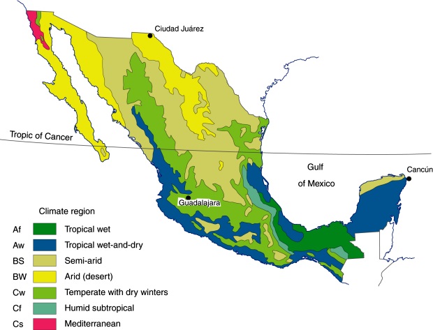
I wanted to include a climate map of Mexico. This one utilizes the classic Koppen system designating the various climates based on temperature and precipitation and their seasonal patterns. Here it has been modified by Mexican to better reflect Mexico’s complicated geography…even so, because of the abrupt changes in elevation, and land forms, different climatic conditions can occur in close proximity to one another. Mountains can create wetter and drier areas that on a map of this scale are lost. The region of Mexico containing the native range of Roldana is shown here as a ‘field’ of tropical wet/dry with scattered areas of semi-arid and temperate with dry winters. Semi-arid in Mexico is interpreted to mean wetter than desert, but less than 30″.
