
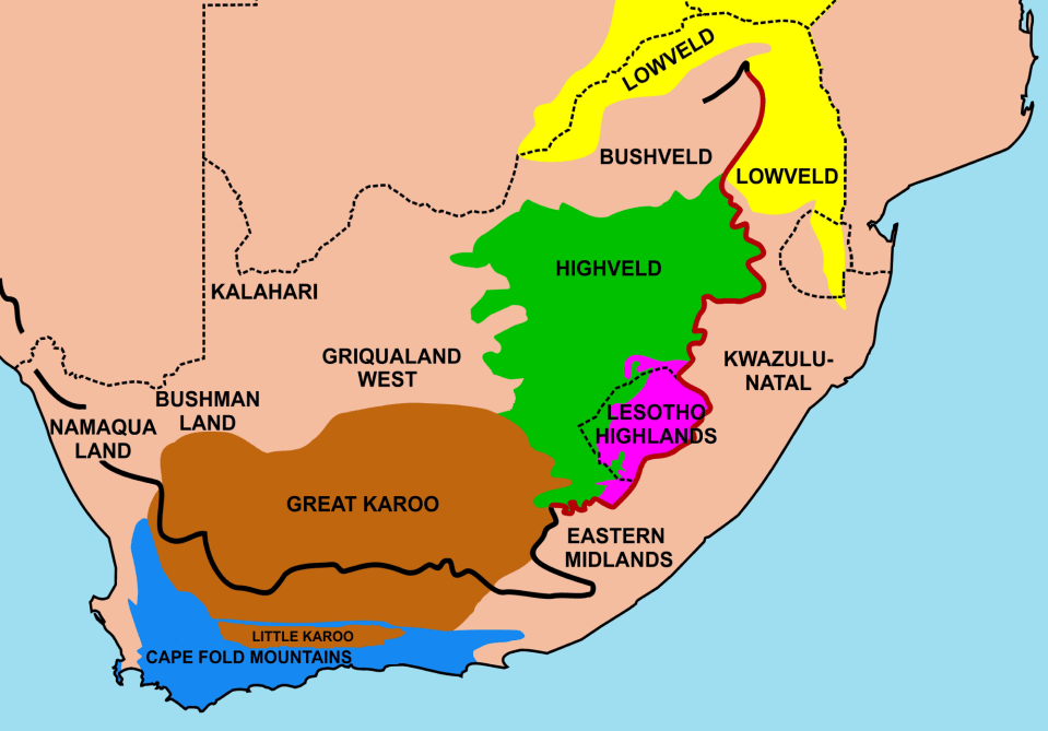
Important geographical regions in South Africa. The thick line traces the course of the Great Escarpment which edges the central plateau. The eastern portion of this line, coloured red, is known as the Drakensberg. The Escarpment rises to its highest point, at over 3000 m, where the Drakensberg forms the border between KwaZulu-Natal and Lesotho. None of the regions indicated on the map have sharp well-defined borders, except where the Escarpment, or a range of mountains forms a clear dividing line between two regions. Some of the better known regions are coloured in; the others are simply indicated by their names, as they would in an atlas. [from Wikipedia]
