
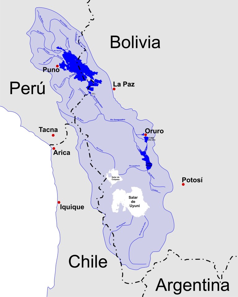
A map of the endorheic river basins that characterize the altiplano. The basin lies between two separated ranges of the Andes, the Cordillera Occidental and the Cordillera Oriental and is without any drainage by river to the ocean. In the north is Lake Titicaca and the Desaguadero River system; in the south is the Salar de Uyuni salt flat. The non-endorheic altiplano extends southward into Argentina and Chile.
