
This shows the effected portion of Dry Canyon Park from Antler, at the bottom, where the new municipal well is located, north to the Maple St. Bridge. The Fir connector trail shows up faintly cutting diagonally across the canyon from Fir Ave, 3 blocks north of John Tuck School. West Canyon Rim Park is labelled on the the left. The trail/dam cuts up, northeasterly from it, gray as it is asphalted, faintly in the pic. The water travelled 200 yds north of it, a bit short of halfway up to the Maple Bridge.
I’ve adopted Redmond’s Dry Canyon Park as a project, so I’ve gotten kind of possessive about things that threaten and effect it…but it is a City Park and cities often have competing demands and priorities. In this case the City is under considerable pressure to keep growing. People and businesses are still arriving here at a high rate and this puts demands on its public infrastructure, in this case its water supply. A city of its size also finds itself in need of more Park lands as people’s private space shrinks, population density increases and we all turn to the same limited landscapes for recreation. Compound this with the demand of wildlife and plants for relatively undisturbed landscapes on which they can simply live. Well, this is a case where two of these priorities have come into conflict, and as usual, the utilitarian demands have won out over those for the living natural world (There is no division of the City or local advocacy group, at this point, speaking up for the natural landscape and the life it supports). The utilitarian ‘needs’ of the community are simply a higher priority than those of the natural world. The State is responsible for our water resource and has control over adding new wells and how that is to be done. It is in at least part a health and safety issue. In this role they require that municipalities flush the wells and conduct a flow test to determine rate, drawdown and recovery. This was to be done by running it at full volume 24 hours a day for four days. At 3,500 gals./min. That’s 5 million gals per day. 20 million gals total. That water must go somewhere. It would have overwhelmed our wastewater treatment plant which is running at close to capacity already so it couldn’t be wasted down a manhole…so, it had to be wasted into the landscape of the Canyon itself.
The City contested this amount. This is almost double the amount used by by all residents on a typical winter day of 2.7 million gallons (In summer, due to landscape irrigation the daily amount jumps to 15.8 million gals.). This was all to be ‘wasted’ across the canyon floor. The City had concerns with damage to area infrastructure and paved paths. This requirement was cut in half and eventually to a single 12 hour period as the flooding/washing problem played out. The amount flushed was 2.5 million gals.
April 14, 2024

The filling ‘reservoir’ abutting the north path.
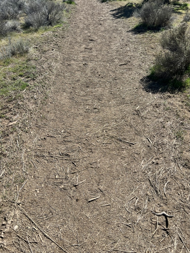
I was unaware of the details of this as I walked the stretch of path this afternoon going north along the west side dirt path, from the trail connector between the main paved trail, extending from the Fir Ave. stairs. I was surprised at all of the surface erosion on and around the dirt path. In some places a foot or more of path had been scoured away, flushed out into the surrounding landscape, its Bitterbrush, Rabbitbrush and other low plants. This erosion continued north following the contours and the trail.
The northern extreme of the test run, where the flow slowed and settled all of the light organic debris.
As the flow spreads and slows larger denser material settles out. Here sediment was deposited in the trail itself and on the ground where the water fanned out.
The flooding had continued a couple hundred yards to where the flow stopped depositing a layer of organic debris the water had carried along.
(I learned on the 17th that this was the result of a test to see what kind of damage might occur and to gauge how the water would spread across the site. This is why the crew was there on the 17th. The test was an attempt to determine the flow pattern so that they could minimize damage.)
April 17, 2024

This section of trail got scoured out about a foot deep, during their limited test. The pattern of scouring and deposition continued along the path north.
Flushing the new well off of Antler began at 11am this morning. Water was to be ejected at a rate of 3,500 gals/min for 24hrs….That’s a lot of water…5,040,000 gals. In 24hrs. An acre foot, enough to submerge one acre under a foot of water, is 325,851 gals. That’s a total of 15.46 acre feet in the projected 24 hrs. The original requirement was to do this for 4 days, running continuously, over 20 million gallons, which the State pared back to 48 hrs. That’s a foot of water covering 31 acres. The original standard would have inundated 60 acres under a foot!
In their plan the area subject to flooding extends from Fir north to the the paved path that angles across the Canyon from West Canyon Rim Park, an area of about 30 acres, which a two day flush would submerge beneath a foot of water. Of course the ground slopes and the bottom isn’t uniformly flat so some areas would be much deeper, notably at the north end where the raised path impedes flow. Low areas tend to collect and channel the water, speeding its flow and can lead to significant soil erosion. The soil here is coarse, not knitted together by plants and their root systems. This is a desert with relatively wide spacing between plants. Surface erosion can be rapid and extensive. It is also a highly disturbed site, with a high proportion of weeds, instead of a diverse and somewhat stable native plant community with its interwoven and relatively deep root systems. The soils here are, therefore, very subject to washing and surface erosion.
This area of the canyon is denoted as a natural preserve. The choice engineers were faced with was limited by the location of the well itself in the canyon. Where even could they put 60 acre feet of water? The major concern here wasn’t for the plants and its community. It was for the potential damage the ‘river’ of water might impose on the paved pathway across the Park. (Civil engineers do have their priorities and they aren’t generally the landscape and the life thereon.) Again, it wasn’t the plant material, the spread of weed seed or the erosive force of the water exiting the pipe and flooding across the loose soil and the problems it could create for the plant community…it was the built infrastructure. Redmond averages 8.8” of precipitation annually. This ‘flushing’ represents a 150% addition, in a very short time, flooding the root zone of the struggling native plant community. Desert plants here, other than those limited riparian plants, which there aren’t any of in the canyon, are notoriously sensitive to excess water. Opportunistic weeds abound and are quick to take advantage of our disturbance and excesses. The weeds, will react to this as a bonanza.

Preparing for discharge near the pipe’s outfall.
While in the area early Wednesday afternoon I saw six different trucks, a quad and a tractor driving around. The tractor was used for some grade work to guide/limit the water, moving material and building temporary dikes to direct the expected flow. The soil surface is broken up by activity, making it even more erodible, while plant material gets smashed under tires. This vehicular damage establishes new possibilities, for increasing ‘informal’ bicycle and foot paths, into the future, while their edges support ever more weeds. Weeds have been self-selected as survivors supremely adapted to the conditions commonly found on such disturbed sites and they possess the vigor to do both quickly and at a high success rate. This is what makes them weeds. Across much of the area accessible to me, was evidence of fresh truck tracks. The public has no access here, so these are from City vehicles heading in multiple directions. Some of this areas was flooding as I watched from the paved path. No one should be in here driving around. This particular section was nowhere near where crews were currently placing sandbags, erosion bags and mats.

The Antler St. stormwater outfall. This is the primary retention area. An overflow takes excess and dumps it into channel running to the dog park. This entire area including the unpaved overflow parking area is left on its own, filled with weeds.
The north of Antler area already receives stormwater overflow from City streets above at Antler, Fir and Maple. The outfalls are generally channeled and are populated with an even higher percentage of weed cover than the adjacent areas. Trash also flushes into these areas along with whatever contaminants may be on the streets above. One of the Canyons functions seems to be stormwater retention, which, again is a conflict if one is claiming it as a ‘natural area’, although, granted runoff from hard surfaces must go somewhere. The proliferation of hardened, impermeable surfaces are a part of urban development and as such should be minimized.
(We should be asking whether we should be building such wide streets, particularly in residential areas, with their lower traffic volume as well as question what we do with the rain that falls on our own properties. Wider streets, larger parking areas, tend to separate us from our destinations encouraging more of us to drive to meet our needs, all of which tends to push destinations, further apart, while increasing stormwater runoff. A section of street, 50’ curb to curb, 100’ feet long, with our average 8.8″ of annual rainfall, produces 3,666 cu.ft. of runoff, 27,000 gals. It has to go somewhere when it can’t percolate down into the ground.
If homeowners saved half of that amount from their rooftops and private hard surface areas, stored it in a cistern for later use, that would be enough, to apply 22″ of water on a homeowner’s 1,000 sq.ft. of lawn or garden, over our summer dry/growing season, enough water to apply almost an 1 1/2″ of water every week. Granted this doesn’t fall all at once, it is spread mostly over the 8 month period of our ‘rainy’ season. Rather than ‘waste’, rainfall could be recognized positively, as an asset we could utilize reducing our dependence on municipal well water. This is another reason why many urban areas are attempting to reduce their impermeable surface area and support solutions to contain it on site. Dry-wells are required here in new developments to contain street runoff on site, which can help recharge ground water. Apparently older neighborhoods aren’t ever retrofitted. nor are streets narrowed to reduce the volume. I can’t help but think that it would be smart to support programs which do this to reduce our dependence and consumption of water. We live in a desert and such frugality, wouldn’t represent a reduction in quality of life. It would help close loops and reduce waste.)
Much of the Canyon, including the north end, serves multiple uses. Sewage lines run the length of it to the treatment plant with its numerous manhole access points, a necessity for maintenance. I was down there one day last summer when crews were inspecting it, driving to each manhole to do so, smashing plants, adding to the criss-crossing pattern of emerging desire paths which will again invite pedestrians and bike riders to use them. If this really is to be a ‘Natural Preserve’, the City needs to step up and treat it ‘internally’ that way. If they don’t, that is a clear message to the public that the Park is available for use however they might choose. How does one argue against mountain bikes and motorcycles tracking everywhere when their own staff and contractors do much the same thing? This speaks to the need for an effective maintenance plan, which is understood by staff and implemented in practice.

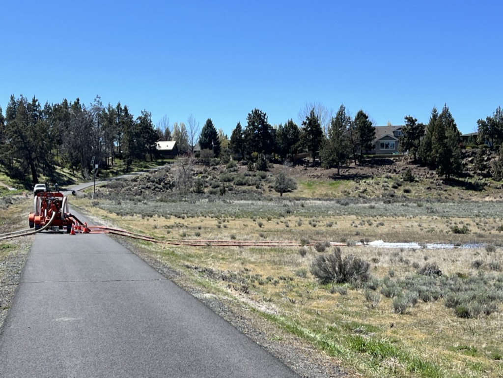
The well site, next to Antler, the dog park and stormwater retention area, to my right.
What are we doing with north Dry Canyon? Scattered Juniper, patches of Bitterbrush and Sagebrush, Rabbitbrush and Crested Wheatgrass heavily laced with weeds, does not make a ‘natural area’. Were its health relatively robust, a park still requires maintenance in proportion to its use and the threats from outside. No park is sustainable on its own. They are ‘islands’ in a larger sea of disturbance, under constant pressure. A hike in almost any undeveloped, un-farmed, area in the region, plainly demonstrates that this landscape is heavily damaged. Without appropriate management, and regulation of use, it can only get worse.
April 18, 2024
Pumping away the last possible several thousands of gals.
I returned to the ‘flood’ area in the canyon at a little after 9am. The well had been shut down last night at 11pm after running for about 12 hrs. Concerns were heightened that the water would take out the paved path cutting across the canyon from West Canyon Rim Park which serves as a ‘dam’ stopping flow north and down slope. Understand that dams are built where they can be firmly anchored, where water cannot seep under or around, undermining them. This is a simple path with a gravel substrate, never intended to contain a reservoir with its particular hydraulics and pressures. And, in fact, the water had risen above the path level and began pouring over into the next section north. Crews shut the flow off brought in large pumps in the night as the water already released continued to accumulate, and brought the level down to where I saw it in the morning. The water was soaking in, slowly. The canyon was carved out by an earlier version of the Deschutes, pushed and squeezed by lava flows and was later, largely ‘filled’ by subsequent flows forming a hardened, concrete like, bottom. No one knew whether the water could percolate down through it or find cracks and voids to disperse underground. The ‘reservoir’, which resulted form the flushing this morning was still larger and deeper than it had been at 2pm yesterday. You can see how deep by the muddy ‘water lines’ on the earlier submerged plants.
The pumps, ‘retired’ last night, were brought back later today and were again working when I came by after 1pm pumping the ‘pond’ down into the north section at a high rate of flow which had to be eroding surface soils away.

This area was very quick to flood. To the right is a line of higher ground which once formed an irrigation ditch. This area was former pasture land and was flood irrigated from a network of ditches which formed barriers to the even dispersal of flushed water from the new well. A close look also show a ‘ditch’ dug for this project to guide water north.
I quizzed a supervisor in the afternoon about the project. Apparently the State reduced its flush requirement from four days running full on continuously…to 12 hours….Still, that was 2.5 million gals. I asked why they had brought the pumps back for the last ‘bit’, why not just let it soak in? He wondered the same thing.
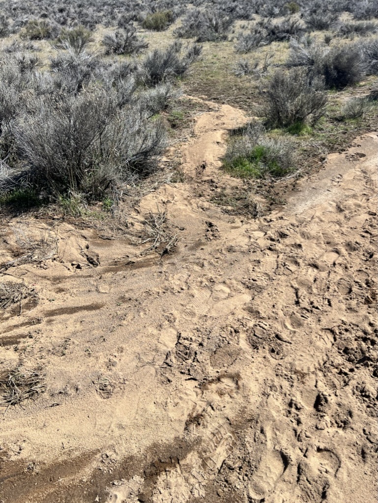
A ‘jail’ crew was back working near the outlet of the surface pipe moving erosion bags and working with shovels. A ‘contractor’(?) was driving his truck south along the line where there’s no road. This particular area is signed and closed to the public. I would have loved to get over there to see the damage. A later inspection showed that damage was done to the trails. Additional was added by vehicular traffic crushing plant material as well as by the tractor work, all of which opens the soil to more weed invasion with plenty of moisture to support its germination. Many of our worst weeds, like Cheatgrass, are very rapid growers, starting in the early spring and robbing soil moisture from natives which tend to be a little slower to germinate and grow, leaving them short. Eroded, washed soil, has now been spread across the site, filling in lower areas, likely burying slower growing young natives, and the roots of established plants, which can weaken them, now with the additional soil load on top.

This shows the growing ‘reservoir’ next to the north path/dam. Your can see the stream carrying the flow, center top. This gives you an indication of the canyon’s grade. The water was never going to spread out into a thin even layer across the site. Inevitably, it would stream and collect as it filling low areas, building up against obstructions.
Landscapes are effected by everything we do. Treating a natural area as an available depository for runoff, and excesses such as this, has consequences. Ignoring those or remaining ignorant of the relationships and conditions in effect, doesn’t make them go away. Our actions are a reflection of our values and understanding, both of which are quite low for the landscape in the north Canyon. I’m not trying to assign blame, just to sound a wake up call. The world is not the same as it once was here. When we act consistently with our past actions, as our population and the use of the landscape increases, our impacts and the damage they cause, can increase dramatically. Damage in a living system does not progress in a linear fashion. Just as in cases of our own health, we are resilient, to a point, capable of tolerating all kinds of stresses and abuses, but cross that threshold and entire systems can collapse catastrophically. Wouldn’t it be best for us all if we recognized that BEFORE we reach that point?
After the Pumping

The western most trail which took the brunt of the initial ‘dumping’ of water. In some places it appears that mats were laid down to reduce the scouring.

In some places the soil was scoured out deeply revealing the rock below.
The aftermath isn’t ‘pretty’. A crew will be back to remove all of the erosion bags, but I have no idea what they’ll do, if anything, to fix trail damage. Along the far west trail where the pipe dumped out, crews created temporary ‘dikes’ to direct water, used erosion bags to slow it, in and attempt to break up the flow and spread it out, to slow it, lessening its erosive force and allow more to percolate down into the soil beneath. Intended or not, most of the flow ended up following the central trail in what is a broad, shallow, swale. Collecting more of the volume as it moved north, the heaviest erosion shifted here filling the ‘reservoir’ forming a pool a hundred yards across and probably 30″ deep before spilling over the top.
The flow into the adjacent landscape then began again narrowly following the contours north. The two pumps, ejected the water at velocity gouging out narrow troughs before spreading and flowing northerly. When I came through again around 3:30 the pumps and crew was gone most of the water spread out and percolated down, but even up here there were saturated areas that were soft and muddy, with standing pools. The varied terrain, not as uniformly flat as that south of the pathed path had ‘fingers’ extending out and stopping, deadended where the rock and land pushed up above the surrounding landscape. It did this stretching another 200 yards north almost finding the central trail that cuts across the the higher basalt scabland there.
-

- This is the central trail which became the main channel over the last 100 yards or so and was deeply eroded in places.
-

- What was left of last night’s reservoir.
-

- Looking south from the same spot.
-

- All of this was flooded
-

- This entire are was inundated and, is unsurprisingly, soft and wet. The Rabbitbrush was just beginning to move in and colonize this area. It is still more than 90% weed coverage, which will probably produce a bumper crop of seed to deal with next year.
-

- The resultant gouges created by the pumping north of the path.
-

- 200 yards north of the path there was still standing water at almost 4:00pm.
-

- Immediately north of the flow is this area of raised basalt scabland with thin soils,
April 26
I returned late in the afternoon to see what kind of ‘repairs’ had been made. The westside, dirt path, had had all of its washed out portions filled, with soil from elsewhere. This was readily apparent in its color and texture. A portion of it, the dark gray material, was coarse and sandy and was previously used as the temporary dikes to direct the flood. The dikes themselves were gone, but for their heavy ‘footprint’ of remaining material. Some portions where filled with a lighter colored material, not from the immediate site. Hopefully, both were clean and no weed problems have been imported with it.
The paths themselves, due to foot and vehicular traffic, grading work, are considerably wider than they once were, and of course the many smashed plants, remain ‘smashed’. As shown in the pictures these areas are quite extensive here and there. Being nearly May, it is far too late to seed these areas with any reasonable expectation of success. Seeding should generally be accomplished earlier to take advantage of limited soil moisture. (Many of the most successful weeds here, e.g, Cheatgrass and several Mustard species, are all early germinators and are very good at sucking up available soil moisture before many of the native species can get established. Many of these weeds are also annuals and speed through their growth cycle, while many of the key native species are perennial, slower to establish, and so aren’t often able to compete with the weedy ‘thugs’.)
The central path, which for much of its length, channeled much of the flow north to the now gone ‘reservoir’ has yet to be filled and is still a gullied ankle breaker in sections.
-

- Washout that remains. There really isn’t anyway to remove this added layer without destroying the remaining plants.
-

- The dark, coarse, material that was brought in for ‘diking’ moved here to fill the eroded path.
-

- This relatively broad smashed area parallels the path to the right.
-

- A broad smashed area adjacent to the path.
-

- Looking south along the central trail, from the connector path at Fir. This gives you an idea of what the area used to look like.
-

- Looking north along the central trail from the connector path.
-

- The removed temporary dike ran into the central trail here with its lighter, native soil.
-

- A low area that was flooded during the ‘test’ across which there was a dike, now scraped off, some of the gray grit remaining with lots of vehicle tracks.
-

- You can see the raised ground here running straight to the right which once contained a lateral from the main ditch in the background from which water could be directed back when this was pasture and it was flood irrigated. The rise cut the test flow off here sending it east to the main, paved path, running the length of the Canyon.
-

- Just beyond this point the water began to collect and erode out the central trail. Across it here, a strip had been scalped away and planted with Crested Wheatgrass, a non-native, which stands out planted uniformly.
