
This is an explanation of the importance of the survey work being done by the Friends of North Dry Canyon Natural Area, FNDCNA, and it’s role in the creation of a broader management plan, and a fire management plan, that addresses both community safety needs, as well as those of the Western Juniper and Sagebrush steppe plant communities in Dry Canyon. This is a 160 acre portion of the Canyon Park that stretches 3.7 miles, north to south, through the City, a remnant of one of the canyons formed by one of the previous courses of the paleo-Deschutes River, (There were at least two, one some distance east of Redmond’s location, joining with the Crooked River at present day Smith Rock State Park. The current Deschutes River flows 4 miles to the west of this location through a canyon carved in its earlier stages by Tumalo Creek.)
-

- This shows the entire area of the North Dry Canyon natural area. Each red cross represents a single juniper tree of 18 inches or greater at breast height, DBH. after a training run around the waste, water treatment plant we began from the south end just north of the first street stairs before skipping across the canyon to the area immediately below West Rim Park. The black lines that you see cutting up the canyon floor define polygons areas created by the cities GIS staff to to help us break up the entirety of the project into chunks that made sense as you worked on the ground.
-
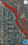
- This shows all the trees that we’ve done in the north end. Each red cross represents an individually surveyed tree.
-
- Here you can see the black lines that define the polygons we’ve been working on. When we complete the polygon and upload it to the City’s GIS that polygon is overlaid with a green tint. Those polygons we haven’t surveyed yet appear as brownish. You can also see in this picture that many or even most of the trees that appear in the aerial photo are unmarked by a red cross. That is because each of these unmarked trees are smaller than the 18 inch DBH that we set as the minimum. Many of the polygon’s borders follow along previously established bike trail paths that were being use when the polygons were created. As we continue with the survey, we are finding more and more trails not showing up on this earlier aerial photo.
-
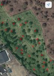
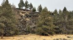
- This pic shows an area within a polygon located just below the west Canyon rim. The gray, which takes up much of the middle here, is tumbled basalt. The basalt was pushed over the rim years ago by the adjacent property owner when the land was being farmed.
-
- When on the City’s GIS site you can select a particular tree by tapping o the cross, highlighting it like the one glowing shown here. Scrolling down below the picture, on the database site, you can find GIS coordinates for that exact tree as well as the DBH, in this case 22”, a picture of it and other pertinent information like a code for its condition.
We’re just returning to the work now after a long extended summer break. It’s a big job to do this over the entire 160 acres. We’re working our way methodically south beginning from the north end around the wastewater treatment plant. We, the volunteers, are doing the actual on the ground fieldwork, and data entry, into the City’s geographical information systems, GIS, database.
We aren’t including every tree. We’re recording trees with a diameter at breast height, DBH, (In forestry, DBH stands for Diameter at Breast Height, which is a standard measurement of a tree’s diameter at 4.5 feet above the ground. This measurement is used to characterize a tree’s size and health, estimate its wood volume, and track its growth over time) of at least 18 inches. The idea is to identify all of the more mature trees, which will give the City a better idea of the ‘recruitment’ that has been occurring over the last hundred years. From this, they can begin to make better decisions regarding which trees should be retained, and which should be removed, to both create a healthier landscape and reduce fire risk. This is necessary because the natural cycling that would have been occurring over the last 100 years plus, hasn’t.
Overly dense Juniper Woodlands typically burn once every 100 to 150 years. Less dense stands survive longer than this having ground level fuel levels sparse enough, that fire intensity is minimal, leaving more open stands intact while burning less healthy portions of a woodland. Lightning caused fires in such areas may only burn the stricken tree and maybe a small area around it. Often times the highest portion of the crown is the only part that burns, the blasted top remaining while the tree continues growing hundreds of years later.
Old growth Juniper woodlands tend to be dominated by relatively widely spaced trees and can attain diameters of over 3’ or a DBH over 9’. They can grow for hundreds of years, sometimes over a thousand. Typically they grow on very shallow soils, often growing on raised rocky areas. Where soils are deeper. and water more available, Juniper’s grow more quickly and thickly, and are much more prone to burning.
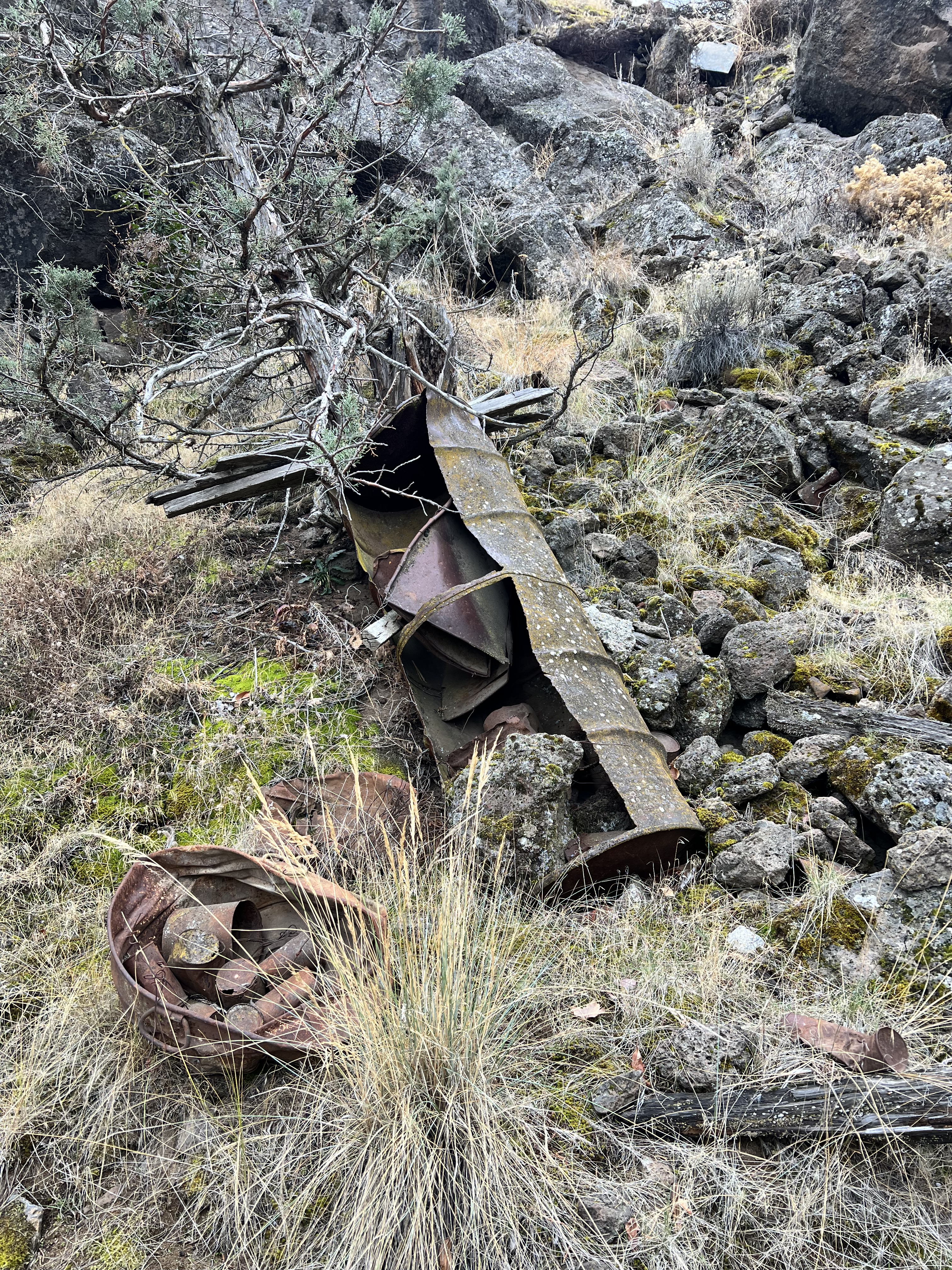
It is also quite common to find debris below the rims dumped by previous owners above.
Fire generally kills all of the Juniper in intensely burned areas, resetting the cycle. There is a similar but shorter cycle for Sagebrush. Sagebrush is particularly sensitive to fire. If an area burns too frequently, the Sagebrush cannot reestablish, a condition that supports invasives like Cheatgrass. Burned Sagebrush areas are typically followed by grassland species, dominated by perennial grasses and broadleafed forbs. Native grasslands require more frequent fire to keep the Juniper and native shrubs from invading and dominating. But too frequent results in domination by Cheatgrass snd other weedy annuals. Fire regimes are complex. The introduction of invadive species adds even more. It is important to note that as Juniper Woodlands and forests grow more densely the shrub understory, including the Sagebrush, Rabbitbrushes and Bitterbrush cannot survive.
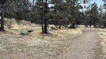
Here’s an example from the paved access path north of the wastewater treatment plant showing an area below the west rim where spindly young trees have been left, a chainsaw crew having come through previously limbing trees up, but not removing any.
The Juniper forest, in several areas within the Canyon, has gotten over dense, putting the trees under stress as they compete with one another as well as greatly altering the plant communities at ground level. Spindly trees are often growing next to more substantial trees compromising both and creating fire hazards. The species is shade intolerant. Crowding causes the lower branches to be shaded out, dying, while encouraging the trees to stretch upward toward light resulting in a weaker tree. This has resulted largely because of human intervention, in this case because of irrigation practices, done largely for grazing purposes, and our exclusion of fire.
These are fire dependent landscapes. For these to remain healthy, we must take on the essential role of fire and do the appropriate ‘editing’ ourselves. Without doing so those areas in which a fire starts, can utilize the available fuel easily resulting in a crown fire. In such a situation, especially where dense Juniper stands occur in Dry Canyon, the fire could escape to the rim above and into the surrounding landscapes and homes.
Another area, the overly dense young trees limbed up. These will never amount to anything as they are growing in direct competition with each other too close together they will all be weak and service potential fuel for any area fire.
The question is not just about how can we reduce fire danger, but how can we do that while supporting a healthy native plant community in Dry Canyon, one that remains both supportive of wildlife and retains those qualities that attract us in the first place. A healthy plant community is a major contributor to the Canyon’s beauty. It is one of those attributes that draws residents to it. Given Dry Canyon‘s use level, especially given the increasing use of electric bikes and motorcycles on dirt trails and across more open ground, the wholesale removal of Junipers will open sight lines and encourage a more free-for-all use, which in some areas is already happening. Such over use is highly damaging, compromising healthy plant communities that would normally be found in steppe regions like this, while also opening the door to the spread of already present, and the introduction of currently absent, invasive plants, plants which under these conditions, are by their nature, more competitive than natives.

Looking out from the paved path toward one of the more densely growing juniper stands their canopies, almost touching. This is a set up for a fire.
Our goal is to aid the transition from the current over dense stands of Juniper, to a more open, healthy, woodland/landscape, over time, which will encourage and support a low shrub ground layer. While flammable, such a shrub layer will not be able to escape the canyon walls given the Canyon’s depth and the dominance of the rock rims and massive basalts on the slopes themselves.
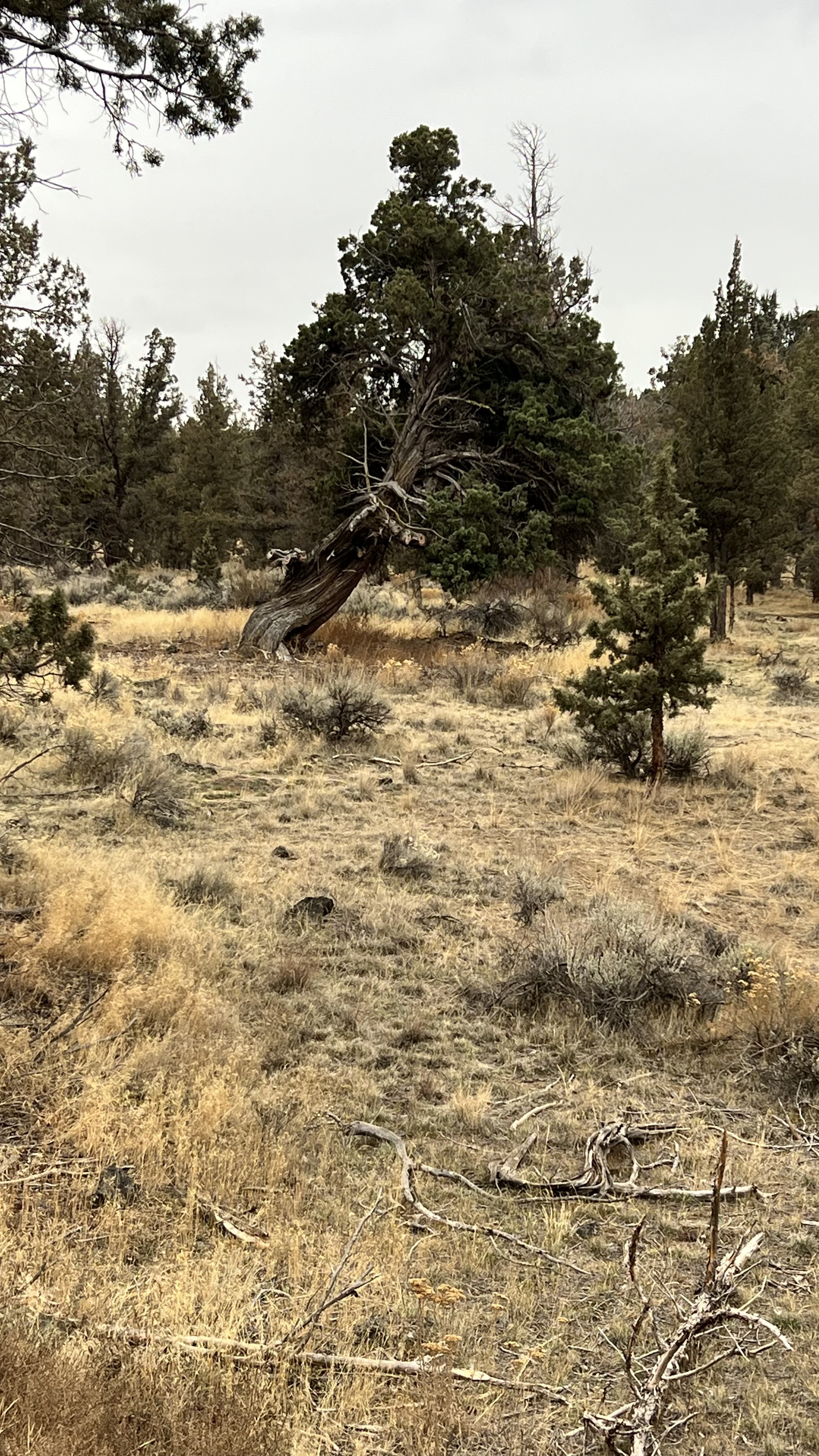
A gnarly old growth juniper with an overly dense stand nearby.
Other areas within the North Dry Canyon Natural Area, primarily the currently, broad open, bottomlands, with minimal surface rock, should be maintained in that grassland/shrub steppe cycle, largely free of Juniper.
This is why an inventory of the Western Juniper is essential. It is a beginning place. Western Juniper is a keystone species in the plant community. You can’t plan in the ‘dark’ and ‘no plan’ leaves Dry Canyon at risk, our uses and management practices, combining with the natural cycles already in effect within the Canyon, working in a way that continues the decline in the health, beauty and, ultimately, the uses that we can enjoy within it. Nature does not rest. It is a dynamic process which is currently out of balance. It is impossible to have an effective management plan without understanding what we have and what relationships exist between the species, their communities and ‘we’ who maintain and use it.
-
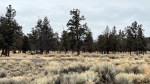
- Looking south across the open bottom land beyond the poplar access trail. Well, this area is largely clear of Juniper, shrubs are largely limited to rabbit brush with a varying assortment of weedy mustards, expanding colonies of Kochia and Tumbleweed.
-
- Turning around, facing north, looking across the Poplar trail into the more densely, wooded northern portion of Dry Canyon.
-
- This is the east rim of Dry Canyon. I include this shot to illustrate its steepness, and rockiness, relative to most of the facing West rim. There’s a reason for this. The Canyon cut by the Paleo Deschutes river followed a seam created by a younger Newberry volcano flow that pushed the Deschutes Westward up against the older flows is showing from many vents that comprised the Deschutes Formation. This also illustrates the fact that our weather tends to blow in from the west, swinging north and south, and only rarely from the east. The soil in the canyon is mostly blown in from the adjacent landscape and spilling in over the west rim as accumulated there helping determine the soil conditions for what will grow there.
-
- Below the West rim the soil blown in in accumulating here covers the rocky terrain below, and has resulted in a broader area at mountain bikers enjoy, the soft fragile soil, easily eroding once the plant cover is torn away. Closer inspection also reveals a difference in the plant pallet below the two rims.
-
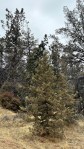
- A young juniper, like most conifers, they tend to grow in a conical shape with a single leader generally evenly branched to the ground. they will maintain this form for many years of protected from fire other physical damage and are not crowded. With great age comes the character that many admire. This is due to harsh conditions.
-
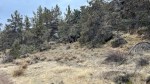
- Again below the west rim with many Spinley juniper’s. This hump has been attracting bikers and they’re creating new trails a higher on the slope. In some places such trails must be being created by electric motorcycles as they’re too steep for mountain bikers to climb.
-

- This gorgeous, dead old growth juniper hasn’t been surveyed yet, but its trunk is probably approaching 3 feet diameter and 9 feet DBH. It’s stubby structure is indicative of an old tree that has grown very slowly.
