
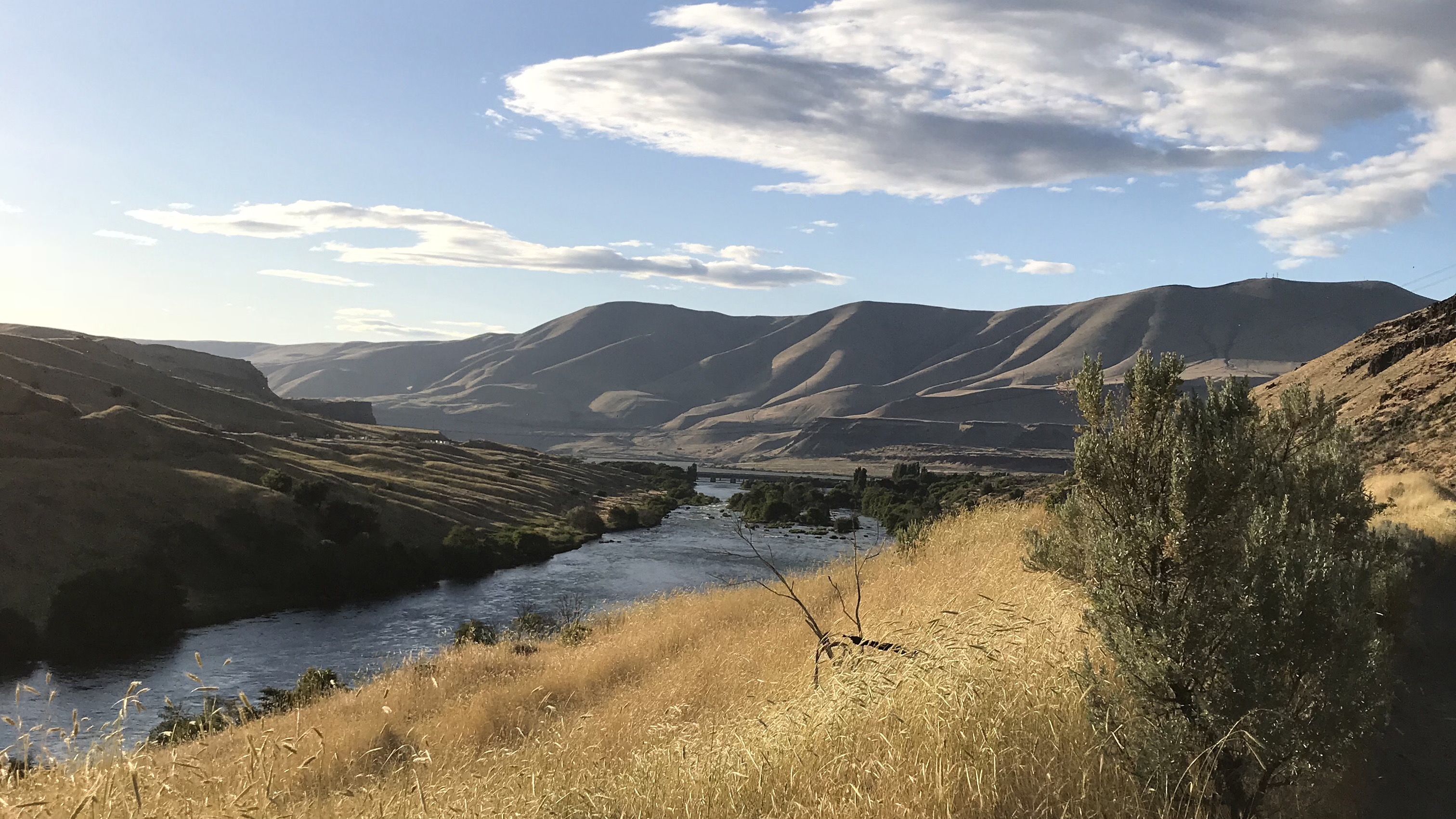
This picture should give anyone more than enough reason to visit here, the Deschutes sliding out its mouth into the Columbia with the Washington side of the Gorge in the distance, the low angled early evening sun illuminating everything sharply.
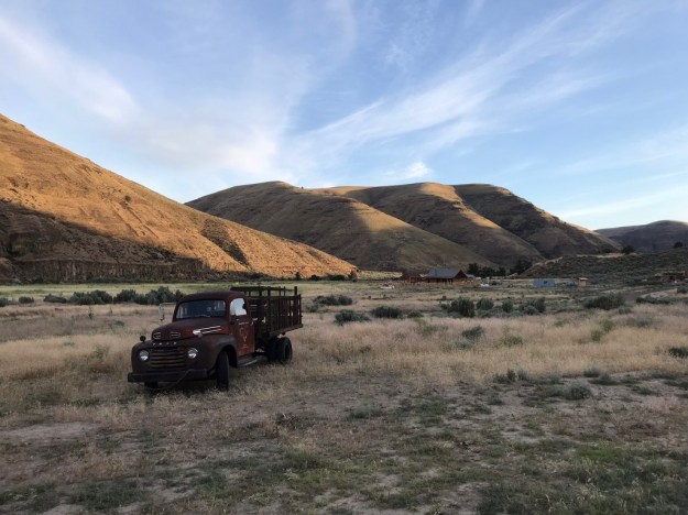
[As I go over this post yet again, July 21, the 80,000 acre Substation Fire is still burning across canyon and wheat country here. Included in the blaze are the 20 miles of the Lower Deschutes canyon down to the campground at the confluence with the Columbia. Much of this burned down to within 2′ or 3′ of the riverbank including the historic Harris Ranch buildings. So, when you look at all of these pictures, with the exceptions of where the fire hopped and skipped, everything is charred. The Oregon Wildlife Federation, formed in the 1980’s to purchase and protect this portion of the canyon, has stepped up with $100,000 to help the area recover. It will take considerably more especially if there is any intention of making headway regarding the spreading invasives problem.]
[Now, another 2 weeks later more massive fires continue to burn across the dried up West that has just experienced another record breaking month of heat, while the president goes on ‘bleating’ and blaming it on our ‘bad’ environmental laws and all of the water we’re diverting into the ocean! ‘F’ing! moron!]
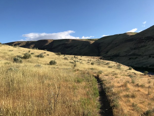
The last time we came here was eight years ago in December. My memory of then is much like the experience on this evening…only it was clear and cold. The light was similar except that then the low angled sun was due to winter, with that season’s urgency, not a late Spring evening like this outing. This time it is warm, camp is comfortable and nearby and the greens are still gathered around the river and the still moist draws and seeps. On that day we’d gone to Hood River for my birthday, to get out of town and there was a break in the weather so we drove here to these trails at the mouth of the Deschutes, hiked along the river, returning on the upper springs trail. Winter or summer, green only sticks around a little longer than we do, before it retreats…life is shier here, tough, but shy. The starkness of this landscape should be read as a warning to visitors, this is no easy Eden. Life is earned here or at least requires a strength, patience and frugality that many don’t have. This is much the same for people as it is for wildlife and plants. Them that don’t, can’t. That’s why it may be surprising to some that such a place has a problem with exotic invaders. What could possibly look on places such as this as ‘favored’? Well, Central Asia, especially its Steppe, with its continental, cold and dry climate containing many species that see such a place as this as home, or even better, without the competitors they faced back there. The temperature can swing widely here on any given day while the seasonal extremes can vary as much as 125ºF from high to low. Relatively few plants can thrive in this. The dry summers with their very limited and sporadic thunder showers, combined with the ‘wet’ winters, total only 10″-12″ or so of precipitation, plus or minus, is another major limiting factor. Of course, near the river, the moisture problem is moderated and a broader range of invasives can find a ‘foothold’. We, as a people, have ‘brought’ these weeds here with us in our travels, often as a result of our commerce. Those that have made it here are spreading. Too many prosper. Continue reading


")
")
")
")
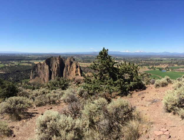


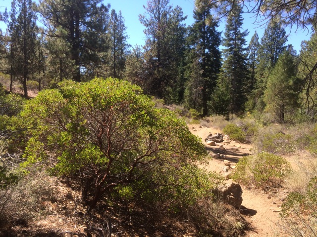
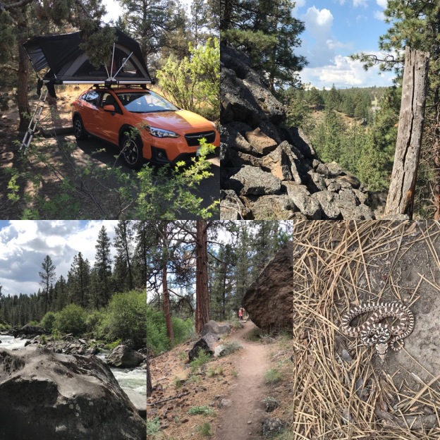
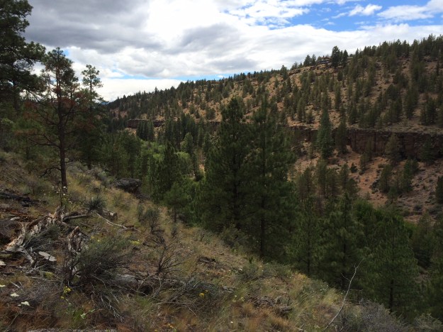 Whychus Creek starts up in the Three Creeks area south of Sisters, OR, below Broken Top and the Three Sisters, and runs north-easterly to where it joins the Deschutes River winding much of the way through a canyon carved through basalt. It’s a beautiful band of green cutting its way through the Juniper – Sagebrush Scrub country where I grew up. I’d never been to the Preserve before and was happy to see it mostly intact. Though development has been creeping up along some of its edges the Preserve is being actively managed by the Deschutes Land Trust these days. We hiked it on June 26 and many plants were still in bloom. Many people from the wet side of the Cascades have never developed an appreciation for the starkness of Oregon’s High Desert country. Julie and I both grew up over here and where some people see barreness we see country defined by its sky, its geology and the spaces in between that set off the unique character of everything that lives here. We took this hike with long time friends, Robert and Elayne, who stayed in Bend when we and others left.