
[I had been delaying the posting of this entry as I was waiting to meet the project manager with TriMet. As I’ve heard nothing back from him, I’m going ahead and posting. It would seem that my earlier posts concerned him, but I suspect now that time has passed and the sky has not fallen…he has moved on to more pressing matters. It is a common tactic not to engage ‘critics’ so as not to give them any energy. Ignoring critics can be effective, albeit, a very frustrating treatment to the one who is being ignored.]
Part 3 of the Series
This is an introductory note. Yes, I realize I started the series in the middle, in a linear thinking world this would have been the first posting, but I live nearest the middle portion of the Line…and I have my own motives. Those of you who don’t know me, I do not mean this to be overly critical in spirit. I’m a person who is always thinking what next? How can I do this better? I have similar high expectations of the organizations around me. Organizations all tend to be conservative in action. There is a reason mature bureaucracies have a reputation for mediocrity. It is not my intent to question the intent of TriMet or of its hired contractors. I am a big supporter of transforming our City into a more livable place and the Orange Line is part of that. There is nothing to be gained through polarizing a situation or setting someone up as ‘the bad guy’ and putting them unnecessarily on the defensive…having said that, sometimes a ‘push’ is in order. We live in times of rapid change, many of them destructive, and it does no one any good to not work toward the changes that they see as positive. That is my intent here.
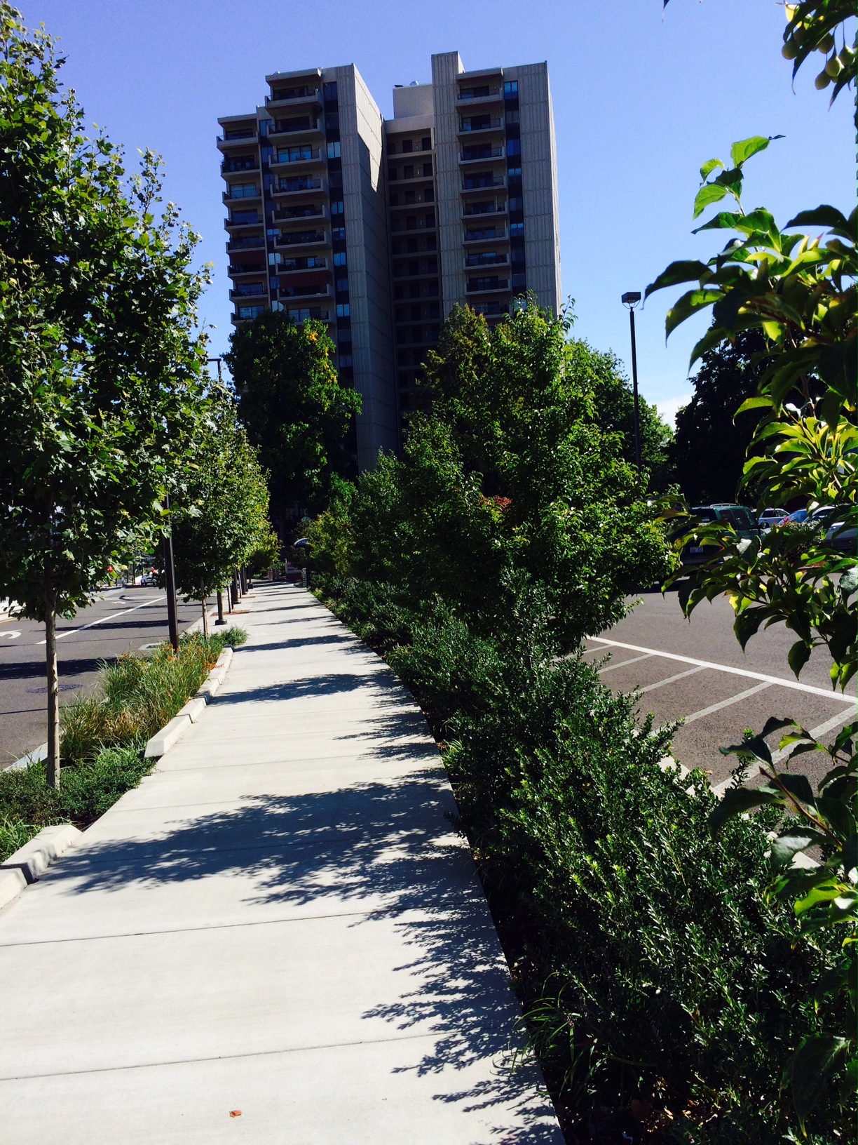
I began this series with a discussion of scale and how it acts as a magnifier. I spent some time talking about the problems caused by compacted, heavily disturbed, soils and I emphasized the issues created by a history of bad weed management…this first section of the Orange Line landscapes, from SE 11th to its beginning at SW Lincoln and 4th is heavily impacted by these factors. Built on heavily graded and or imported fill, often on abandoned industrial sites, on or adjacent to sites that have been out of control weed generators for decades, this section may pose the biggest problem for landscape maintenance of all.
It is dangerous to assume that a new urban landscape is created on a ‘blank slate’. Merely scraping a landscape off and beginning anew does not return it magically to its ‘pristine’ condition prior to the arrival of ‘modern’ white American culture and all of our accumulative impacts. To be successful some effort must be expended to ameliorate at least the worst of these conditions. Even if we make our ‘best’ effort to do this, landscapes such as these with their ‘heavy’ impact histories will present a powerful challenge to those charged with maintenance. It is easy to underestimate the severity of this problem. We have developed an ‘alien’ aesthetic that really doesn’t belong anywhere and as such is outside the bounds of the function of the normal cycling of energy and resources common to nature. We impose this aesthetic and our designs on our landscapes and then expend a great deal of energy, in the form of labor and chemistry, to maintain them, or they quickly degenerate. In some ways it would have made maintenance much simpler to have buried all of the surface beneath concrete sealing the problems beneath it. But then the priorities of urban tree canopy, the capture and ‘treatment’ onsite of stormwater would have been negated, the possibility of groundwater recharge further reduced and the ‘softening’ of a very hard edged urban ‘landscape’ stymied.
Leaving the Clinton/SE 12th Station and heading west toward downtown takes you across the congested intersections and rail stops following a route behind warehouse space and ‘below’ Division St. The bluff next to Division St, built up with fill, follows the northern edge of the slough that once stretched and widened into the wetland that ran back through what has been the Brooklyn Switching Yard for decades now. Prior to the Orange Line construction no one cared for this ‘landscape’ beyond the railroad’s anti-vegetation/sterilant program. It was all vacant/waste space and left largely to itself, for decades supporting the uncontrolled growth of weeds freely increasing, producing seed and yielding only to the more aggressive weeds as they moved into the space often via the trains, but also blowing in from elsewhere or deposited by birds. The soil-seed bank is demonstrably dominated overwhelmingly by many of the region’s most aggressive weeds as a result. This will present a challenge for landscape maintenance staff for as long as viable seed remains in the ‘bank’, which could be for many years, even if there are no more deposits made, a situation given the location, that is highly unlikely given present circumstances. (Please see my previous posts on single use corridors and railroad rights-of-way and weeds. Note that the pictures once included have been ‘removed’.)
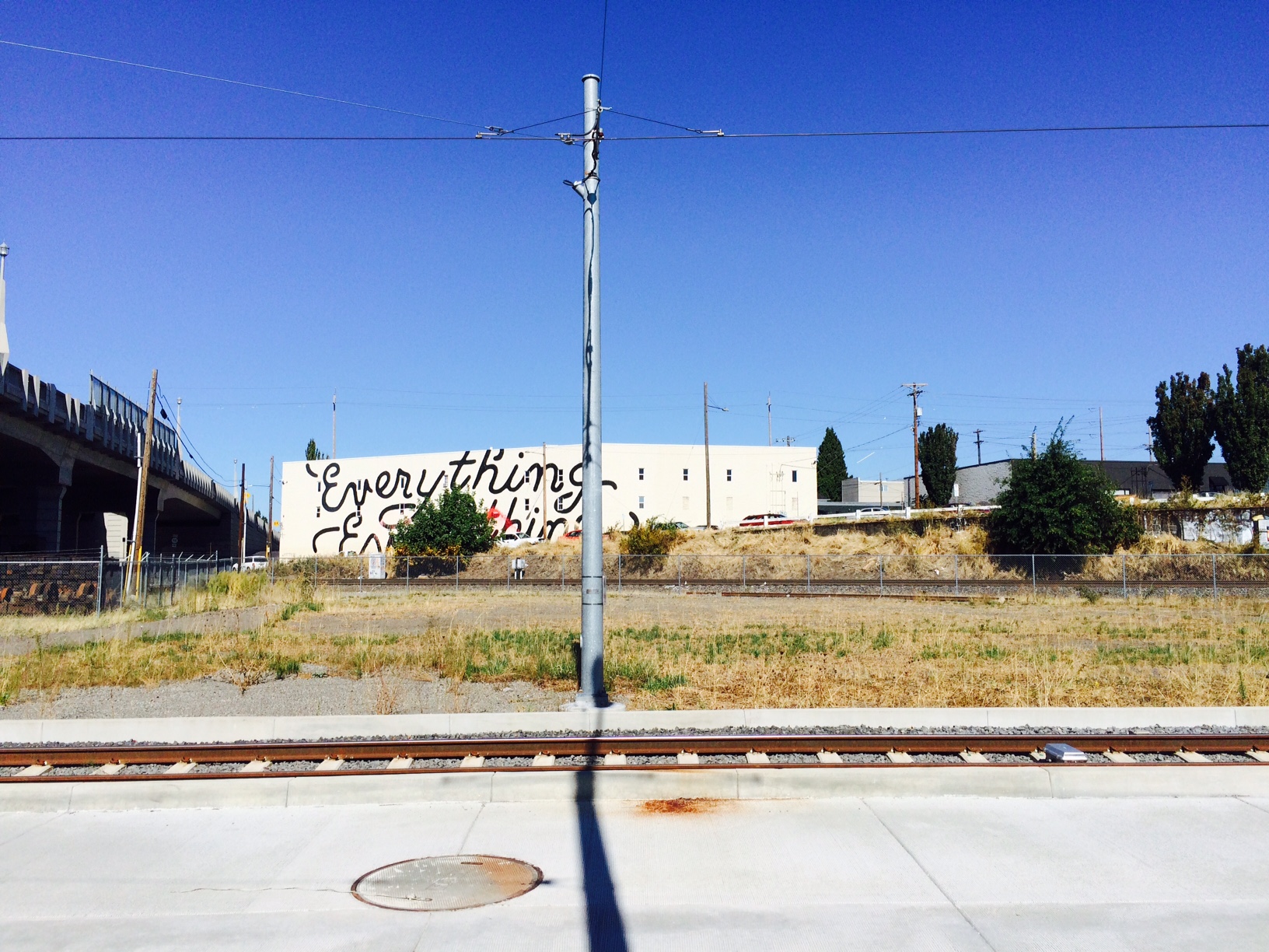
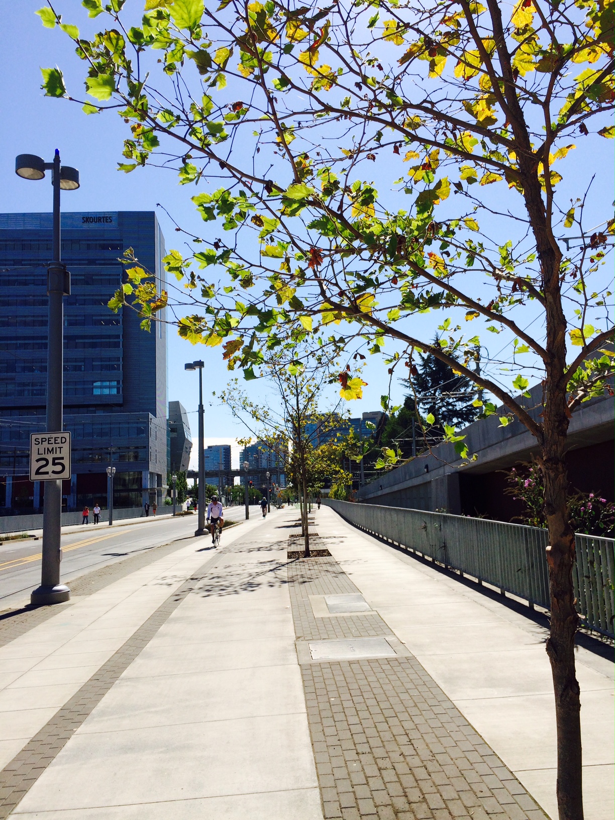
There’s not much in this first section between SE 11th and 9th, fencing gravel, tracks, a broad strip of weeds and a mural of an exploding blowfish on a wall. The #9 bus uses the ‘street’ here on its way to Powell Blvd.

The first ‘bed’ heading toward downtown where a stub of Division curves south on 9th. Nothing but Vibrunum davidii with a telephone pole. Vibrunum davidii, again, is an overused Japanese woodlander here used in full sun, exposed to reflected light and heat. I will be very surprised if these fill in, shocked if they ever look good. The wrong conditions all around. Landscape as space filler and barrier. Why?

There are two beds comprising a long triangle stretching east from 8th Ave and the crossing. The Nyssa sylvatica trees look extremely stressed here.
The beds framing the 8th Ave crossing were planted a year or so ago. Much of their growth is robust…as is the that of the weeds they share the space with. It looks as if little if any weeding was going on since then as the weeds have reached mature size and most of them have flowered and are heavy with seed. Canada Thistle, Epilobium, Common Groundsel, Cat’s Ear, Blackberry, Oyster Plant, Common Mullin, Cottonwood seedlings, Dock, Black Locust, White Clover, Klamath Weed, several course weedy grasses, Chickory and Dandelion, among others less identifiable to me. Many of these are large physically dominating the plantings. Add in the extremely stressed Nyssa sylvatica trees in the bed and it is a disaster. Zelkova trees serve adequately as street trees and a couple of green streets with the usual suspects edge the other side of the street.

This shot shows the white fluffy seed heads of mature Canada Thistle. Weeds dominate this bed forming almost solid stands in several areas.

This is the bed on the west side of the crossing with alternating bands of Spiarea and one bunching grass with Nyssa sylvatica.
Every plant you see here, though in their end of summer baked form, is a weed, including the trees. This is what dominates this corridor and has for decades. Okay, not quite. The four trees in the background above the bluff were planted in commercial landscapes. The staging area in the middle-ground is filled with weeds that have recently colonized the compacted gravel. These are very aggressive especially in a vacuum or a landscape with many empty niches such as the ones planted along the Orange Line. What will keep them at bay?
 This is a little further west with a construction office and left over materials. The Butterfly Bush to the right has obviously been let go for at least a couple of years and is heavy with seed. Buddleia davidii is on the City’s invasive list. No attempt has been made to control any of the weeds here.
This bio-swale is doomed. It lies between the areas pictured above, is narrow, with lots of invadable edge and is away from pedestrian, bicycle and vehicular paths. Walking along here you can see the beginning of the end already. All of the issues with soil compaction, depth and sterility apply here as well.
Landscapes, such as the above cannot be built in wastelands like these with any expectation that they will succeed unless a great deal of effort is committed to their management. It would appear that this is not the case. It is also obvious, based on their record, that the railroad and its contractors, have no incentive, without a great deal of public pressure, to change their practices in ways that not only limit their weed impacts on adjacent landscapes, into landscapes that may contribute positively to the soil seed banks through which they pass. While the landscapes on such projects as these are relatively inexpensive compared to the total cost of the project, it will be money wasted without a considerable commitment. It is very common to mandate landscapes as part of such projects while requiring nothing in terms of subsequent maintenance. We see this all over the City with new construction, public and private. Landscapes are undervalued. Landscapes are built without the understanding needed of the sites upon which they are created. Our priorities and value systems today are blind to landscape and we make little to no effort to educate ourselves.
This street-scape lies alongside Caruthers with the railroad and staging area immediately north.
The route continues west to the OMSI/ Water Ave Station. This shot shows the bed at Water Ave with the old PPL site adjacent to the north. This I believe, is a state recognized brownfield site, contaminated with PCBs. There are strict DEQ regulation of such sites. They are ‘hard capped’ to minimize the percolation of water through them that might carry contaminants offsite and/or into groundwater. You can’t really see this but this strip with its Western Red Cedar is planted in about 1 1/2′ of topsoil above the hardcapped original grade. There is also a row of Gingko trees here. Tree roots are expected to stay in the top layer. This is a common problem on such sites. What happens as the trees grow? Mighten they be likely to topple as a result of inadequate anchorage? I will also mention that if these are species Cedar they can get very broad and will take over the concrete walk if not limbed up. Even if these are the ‘Hogan’, narrower form they will form a continuous hedge that leaves no space for the Gingko trees and will still encroach on the walkway. Liriope dominates the space inbetween backed with Ilex crenata ‘Convexa’, a very durable evergreen. The pure stand of Liriope will show all imperfections and this is not a good site for it so that will happen.

I don’t know if the near landscape belongs to TriMet or the Oregon Ballet, but it is interesting because it contains a fruiting Poke Weed, a plant that is quickly becoming problematic all over east Portland. The rest of the landscape here is very minimal all built on fill as the rails ramp up to Tillikum Crossing.

A couple of more ‘green streets’/ bio-swales amongst a sea of concrete.
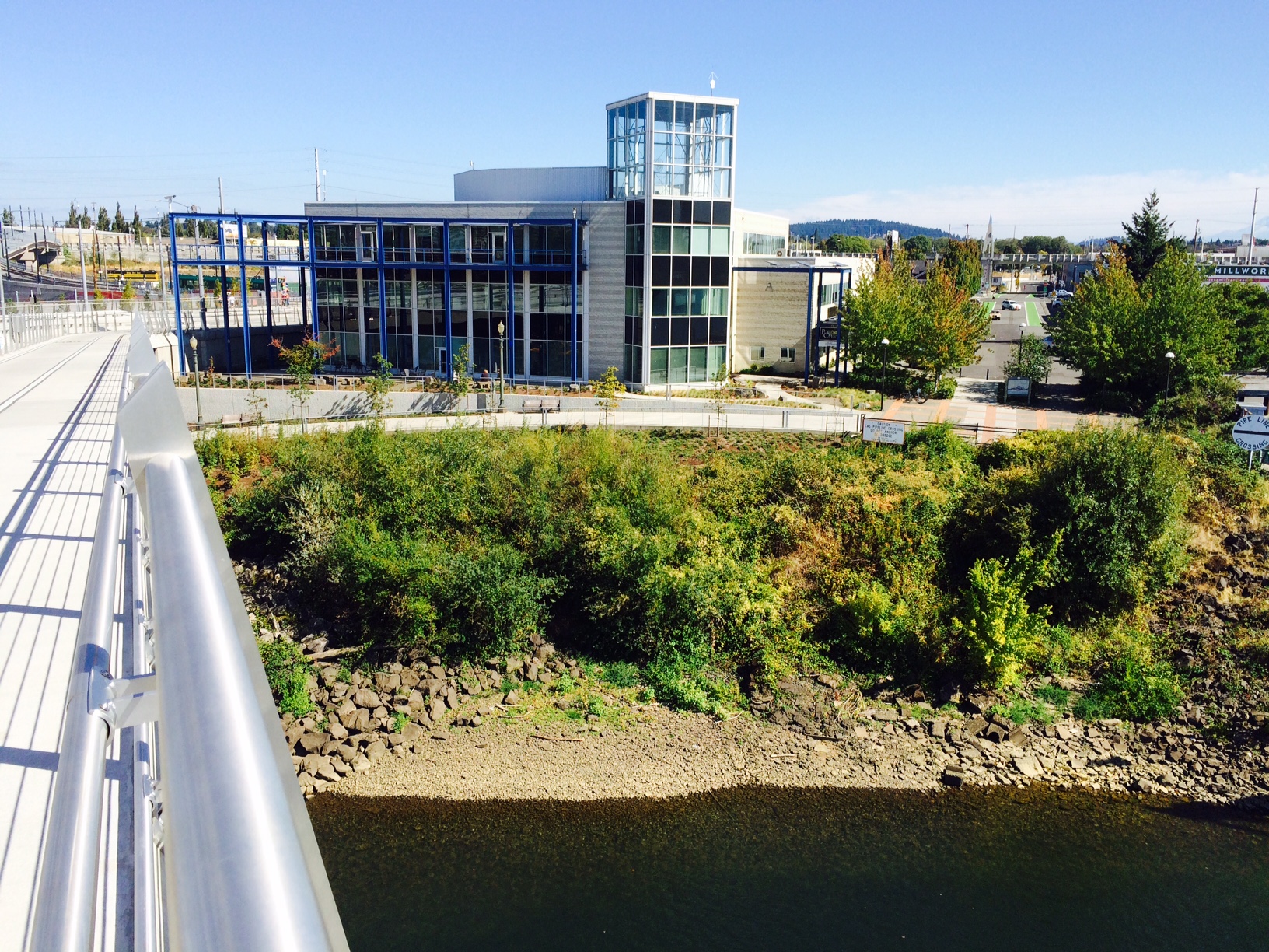
I could do a whole posting on the problem of the Willamette’s banks created with countless yards of fill, armored with basalt, concrete and other waste construction materials. Some of the these areas were planted with a very simple palette which has been heavily invaded by weeds including Blackberry and Butterfly Bush, it is even worse on the bank abutting OMSI, which I find interesting as it is a science organization ignoring its impacts.

When they built up the river bank it was obviously more important that they create buildible land than a healthy riverbank. Some where in here was where the slough began. Much of this was wetland all of the way back east to old Union Ave, now MLK, which was built up on trestles. The original bank rose up just north of the east side bridgehead to the Ross Island Bridge.
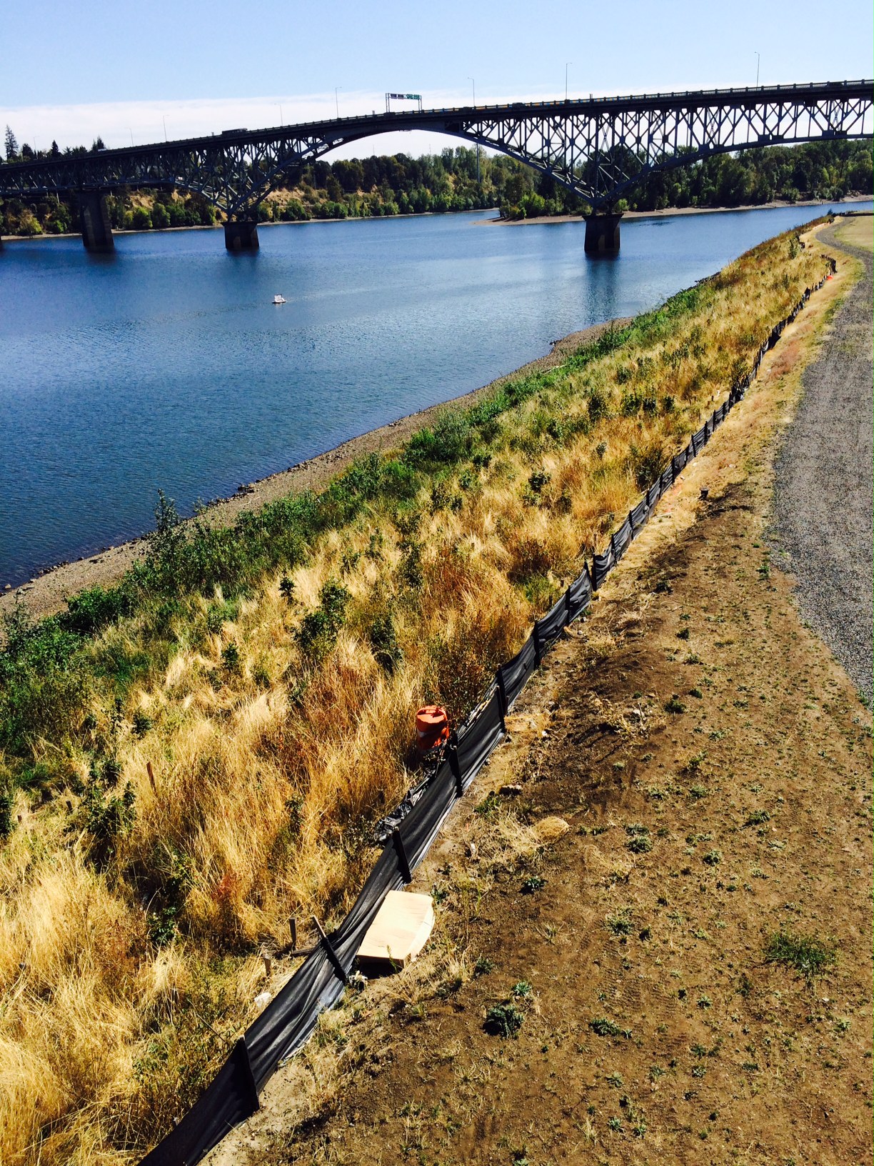
The western river bank once looked much like the east, rubble, fill and weeds. It has been modified as part of the required mitigation for all of the development occurring here now including burying the river bottom with many tons rock so that any future work couldn’t disturb the contaminated sediments there . It is much steeper than it was originally. Channelized as it is now flooding now happens more quickly and can be more severe without the wetlands to spread out on slow the flow as it backs up.

This shows the soil cap covering the brownfield on this side which was once a shipyard and is contaminated with asbestos and an assortment of other industrial chemicals. This is a very common treatment of contaminated sites ‘topsoil, which is generally a uniformly graded and sterile mineral soil, is layered on top of the hardened grade to contain the contaminants. To remove and treat the soil would be cost prohibitive to put it mildly. All construction, unless carefully reviewed, must stay above this line whether trenching for irrigation or drainage or planting holes for trees. Excess rainwater has to be carried off site. It is not allowed to penetrate and percolate down through the soil profile. This creates a ‘perched’ water table at and above the interface of the two layers which is often problematic for plantings as the lower levels are saturated and thus often cause roots to rot and create anaerobic conditions.

This photo shows why on the west approach the beds are all essentially large containers. Drainage has to be engineered in. You can see that all of the construction is at least 15′ and more above the surrounding grade.

All of the beds, both here at the South Waterfront/ Moody Station as well as most of the Moody Ave portion are raised above the grade and use some kind of soil mix.
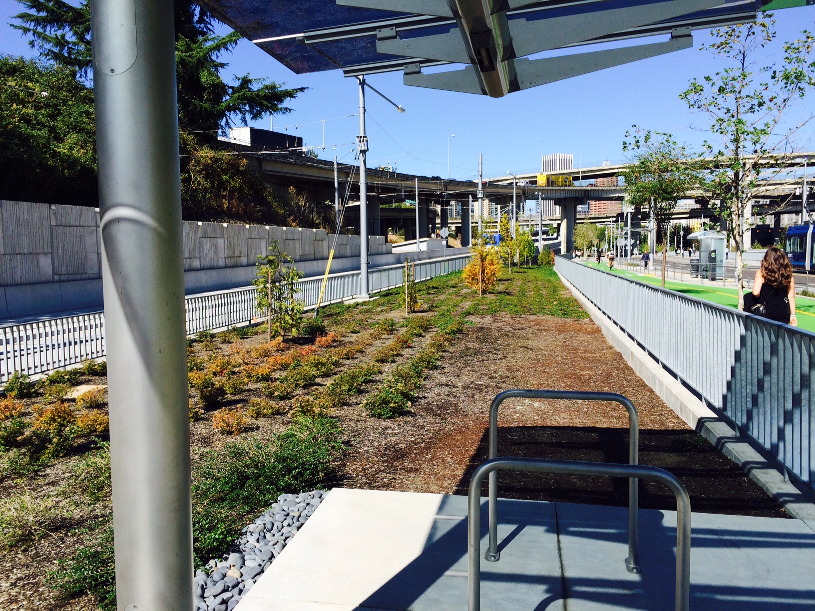
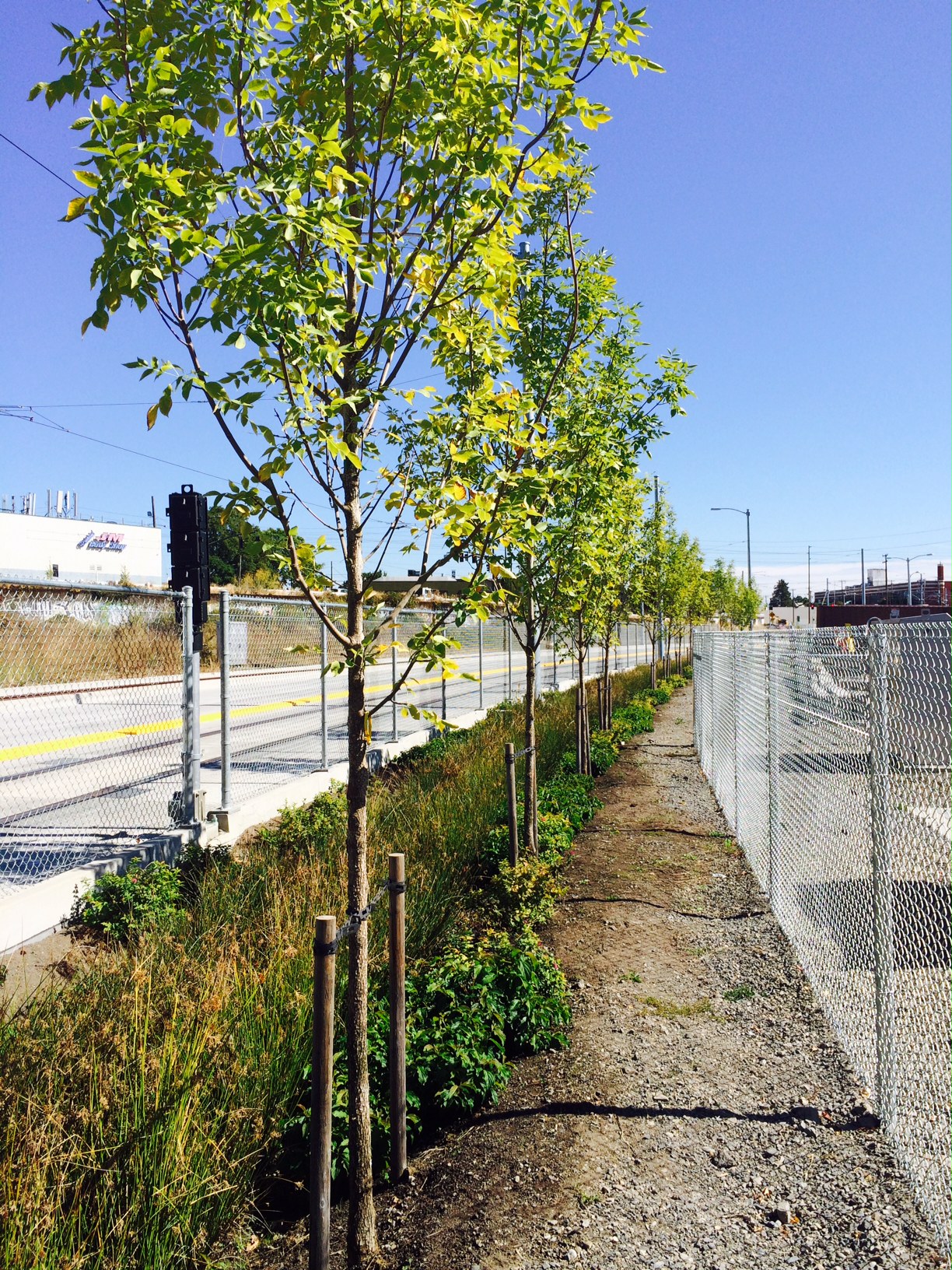
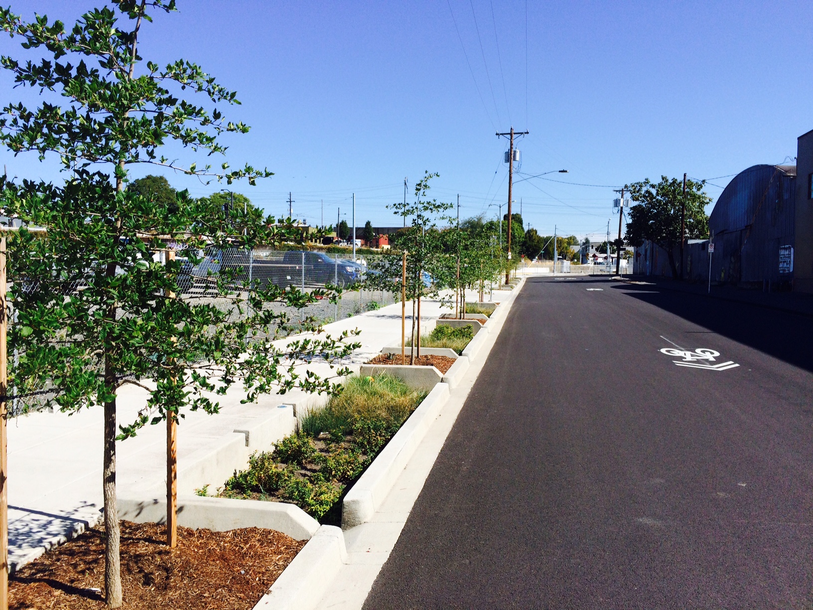
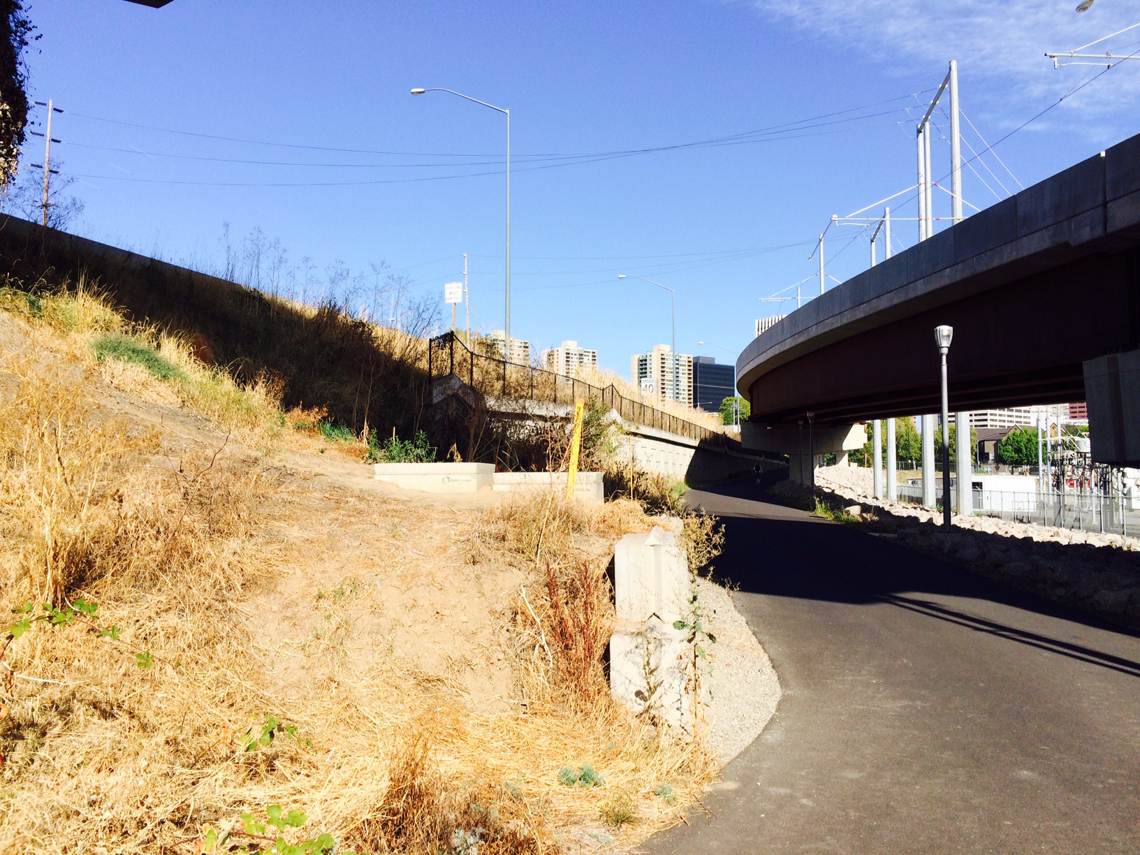
This is looking north along Moody Ave, the Orange Line to the left, the pedestrian, bicycle, trolley and car traffic to the right. It runs here north here more than 100 yards, plateaued, before dropping to the surrounding grade, again all of the plantings in imported soil or mix and all under irrigation as is typical. Here we are back to the large single species bands characterized by empty niches, even a section left unplanted. A smaller form of Spiarea, Strawberry, Kinnickinnick, but nothing intermediate in stature, no grasses or mix of herbaceous perennials. A row of Incense Cedar marks the mid-line of the planting, trees that are perfectly drought hardy here after establishment, several of which have already died, some cut down, from either drying out too much this summer or flooded by someone overly worried by the summer’s heat. This is a sizable planting and it’s extremely simplistic/ vulnerable.
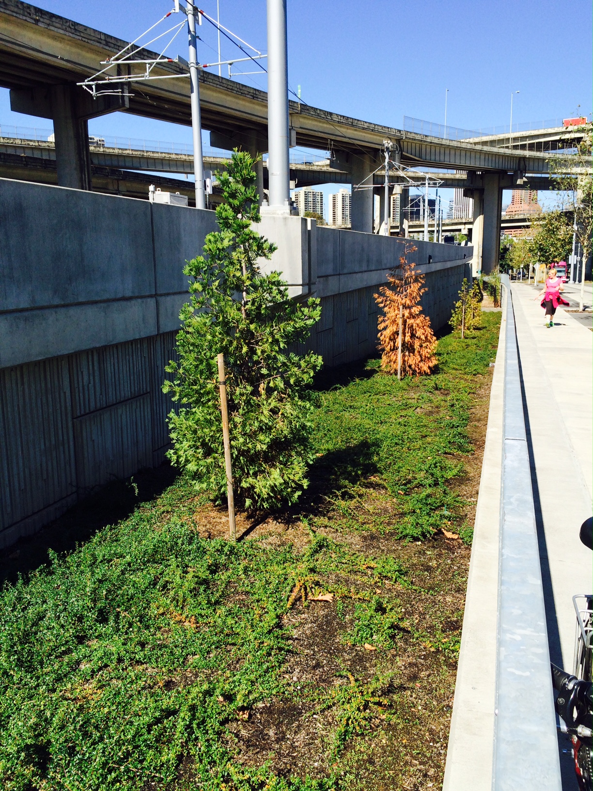
The Orange Line is slowly climbing and you can see the road grade here where it starts to drop. Another dead Incense Cedar with regularly irrigated Kinnickinnick, which will be harmful to it as well over time.

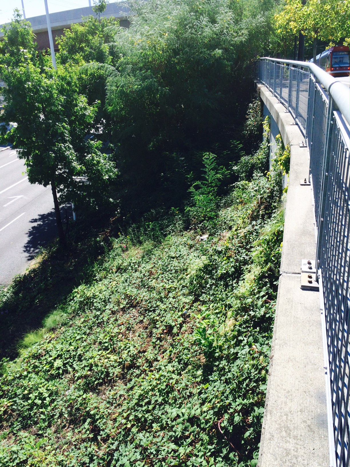
That bed ended abruptly at a wall. The Orange Line continues on supports devoid of any plantings beneath it. Nature/ vacuum…not for long. It’s already collecting trash. Next to and below the walkway is a no-man’s-land created by a fence already filled with mature Buddleia davidii. Fence-lines and edges can create all kinds of problems for maintenance.
Normally Sycamores are real tolerant urban trees. I don’t know if these were heavily stressed before they were planted or after, but all of these are typical of the one shown here. At minimum this show poor handling of the stock before planting or an irrigation schedule issue along the whole line.
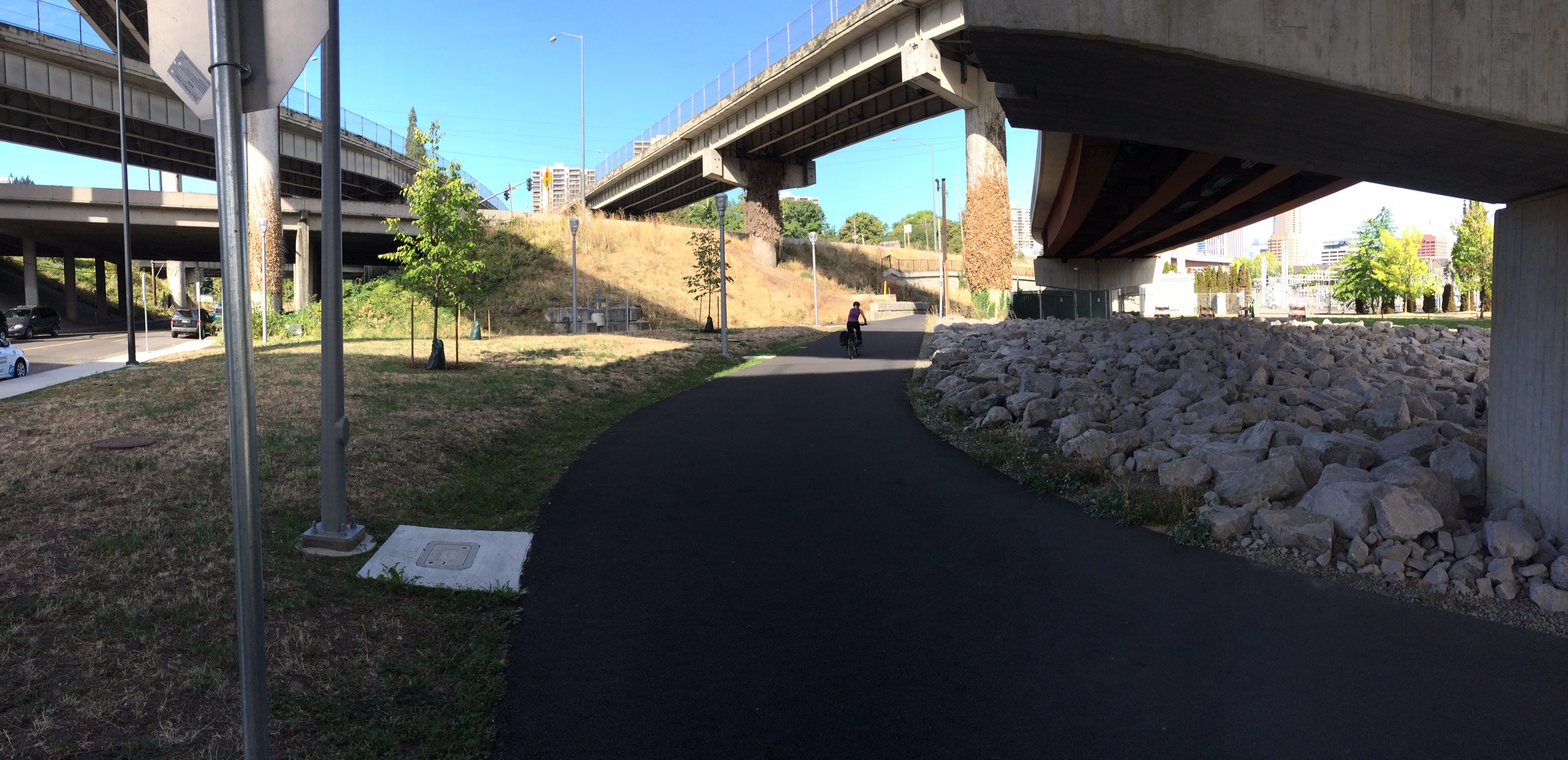
The Orange Line swings through space above to the right on it way to its crossing with Naito Parkway with the bike path following below. The other ramps all connect to the Marquam Bridge. Other than a couple trees very little of this portion is ‘landscaped’. It is left to its own ‘devices’. The column on the right covered in dead Ivy and regrowth tells something of ODoT’s commitment to its landscape. The Ivy is cut sporadically. The rock, rip-rap, appears to be an attempt to stymie weed growth below the Orange Line.
There was no attempt to landscape the bank here above the retaining wall. Above to the left is the traffic feeding off of I-5 that will join Naito at Market and Clay. Another ODoT landscape.

A more closeup view. Mature Buddleia davidii. You can see the dry stems above of weedy Fennel.

With the Orange LIne above the bank below has been armored with ‘rip-rap’, broken rock. To the right, in heavy shadow is Blackberry starting out above the wall which can quickly fill the space including the bike path and the ‘rip-rap’ if left untended. Horsetail has a good start at its base. Many weeds are perfectly adapted to invading rip-rap especially over time as dust and debris accumulate within it. The rip-rap makes pulling, digging or hoeing nearly impossible leaving you only with cutting or spraying. It also makes footing more treacherous. It should also be noted that the rip-rap will make it much harder to establish any desirable plant community in the future unless removed. Who knows what will be built to the left here or how close. This bike area could become a real hole, out of sight and neglected. It is certainly set up for that.

I hardly know where to begin with this. This is where bikes can cross and head up to Naito on Harrison with the trolley. Or, riders can continue ahead next to a bank of Blackberrie,themselves buried in Clematis, on their way toward the Riverplace Athletic Club and Waterfront Park.

This is the bike/trolley crossing. This is all pretty wild and unkempt. The ground level plantings are very weedy and the two taller masses are Honey Locust sprouts. More of these repeat to the right of the frame. It’s a mess and has been since this was built for the trolley several years ago.

Here the trolley passes under the Orange Line above where it lands at Naito Pkwy. The only landscape other than the trees is ‘rough’ lawn area that is periodically mown which will at least contain the spread of Blackberries and woody invaders.
Looking back toward the trolley crossing at Harbor Dr, this is nothing but weeds. The whole bank is Ivy, Blackberry, Clematis, Honey Locust and many herbaceous perennial weeds. There appears to be no maintenance other than cutting the mass back from interfering with vehicular traffic and pedestrians. This portends nothing good for the Orange Line in its future. As you head north there are plantings of Northern Red Oak, a large, fast growing shade tree, that is continuously seeding in and sending up volunteers that could overwhelm the entire site. The Northern Red Oak, here is a weed.

Looking north from the trolly tracks, close to Naito Pkwy. The canopied structure in the distance is the Park Ranger headquarters. This was once a Parks maintenance facility. Prior to the construction of the Trolley line here there was an entrance for the parking lot here at Harrison. TriMet has never taken responsibility for this area. Parks would send occasional crews in here to do gross cleanup.

Looking down Harrison along the trolley tracks with a sprouting planting of Gleditsia. Honey Locust regularly sprouts forming thickets if no on is available to thin or remove them. This can form hiding places or effective traps for trash obscuring line of sight. Next to a trolley stop this might inhibit the stops use. It also creates an unobservable area in the adjacent parking lot.

A great little bike path segment separated from heavy car traffic until it is pinched down at Harrison. The large slope down to the right is a sporadically mown rough area created when Harbor Drive was vacated to make Tom McCall Waterfront Park in 1974. Not much has been done with it since.

The Orange Line swinging in here at Naito Pkwy crossing the old Harbor Dr. property that still contains tunnels beneath it. The raised portions contain no landscapes.

This is SW Lincoln St. There is very little in its 4 blocks except street trees and narrow green streets plantings. Quercus frainetto is in this section.
Typical Lincoln planting.
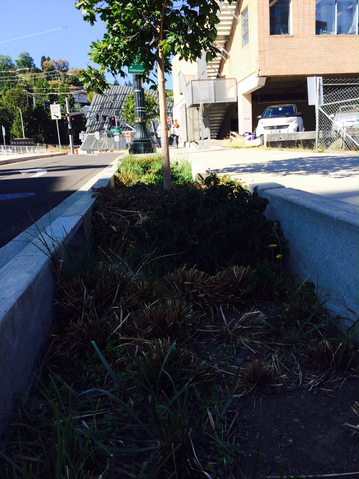
Not the greatest picture but it shows the depth of the green streets ‘troughs’ and how abruptly they grade up to where the street trees are planed. Not sure what happened here to the Carex in this one.
Every landscape could be ‘better’, its maintenance performed more thoughtfully, more timely, so why ‘complain’ about this…and who is to say what is better. Managers don’t have unlimited budgets. They are ultimately responsible to the public, a public with many faces and voices, often in opposition to one another. Not only do organizations have priorities, but they have habits as well, often even codified as formal procedures, formal structures, in part to reduce the chance for favoritism and corruption. This is the norm. Businesses, successful ones, learn to work in this world. It becomes a ‘relationship’, the way things are done.
Major capital projects like this take years to accomplish, even in the development stage. They require huge outlays of public money. No one wants them to fail so the process is slow, tedious and conservative. There is a public expectation for it. If you’re going to innovate, plan it to death and limit all of the ancillary, supporting design and work, making it as simple as possible, to keep ‘non-essential’ costs down and insure that their construction goes smoothly with costs at or under budget. With the Orange Line it wasn’t the landscape that was the concern. This was a major transportation project. That’s where the emphasis went…where it had to go. Landscapes have only a minor supporting role in this project. Landscape had to fit the engineering. This was after all not a Parks or a beautification project.
At some point in the overall project design process a RFP, a Request For a Proposal, was sent out to qualified Landscape Architecture firms, firms with a record of projects of such scale and ‘type’. Specifications are written for the project and competing firms put together mostly conceptual proposals, including themes, renderings and estimates and from these a firm or group of firms are selected to do the work. This is important, especially in jobs of this size, because everything must be decided relatively early in the process so that plants of adequate size, quality and number, can be secured and the landscapes completed in a timely manner. Plants are not widgets to be produced on demand, they must be propagated and grown. If other buyers beat you to them, you must wait another cycle. Project Managers, who oversee construction, do not want to be held up at the end, because plants were not secured and everyone is scrambling when things should be being finished. There are always loose ends and this is another way to minimize those that they can. All of these factors push the landscapes of large capital public projects in a conservative, known, direction. The landscape architecture firms are involved all of the way through the processes of design, procurement, substitutions and installation, often down to individual placement of specimen material. In projects like this one there are many very limiting conditions involved with sites on top of state regulations on sites that are designated ‘brownfields’, contaminated sites. Many landscape architectural firms neither have horticultural expertise nor contract it. A few do. The two involved here don’t have such staff. This is common. It is as if horticulture is a further complication that none of the parties want to take on. This is common practice in public projects in the region. Horticulture is limited to a role in maintenance, or is called in when there is what could be a failure that could bring public embarrassment. Horticulturists seem to be perceived as worrying over unnecessary details which will add costs to a project. Horticulturists have not been in the decision making process. If involved they are asked to comment and their input is weighed against the priorities of, Project Designers and Managers, the landscape architects and upper level managers. They are not inclined to invite others to the table…nor do they generally require horticulturists to be part of a firm’s design team.
The Orange Line landscapes are typical of public projects today. They rely on an almost static palette of plant material, installed in accordance with designs that are ‘graphic’ and simplistic, that ignore many of the conditions involved at any particular site. The burden is then put on the maintenance staff or contractor to maintain them. Overall, this process ignores the issue of our worsening urban conditions within which we live and these landscapes must exist. They ignore the fact that the world is changing politically in that there is less and less tolerance for the regular use of pesticides to maintain these landscapes and that with this changing politics it is making it nearly impossible to maintain them at an even basic level that the public will accept. And, lastly, there is no allowance, within this commonly shared process, to begin developing a new ‘process’ that is working toward the creation of landscapes that are more site sensitive, attuned to their conditions, that won’t require a huge investment committed to fighting back the natural forces at play on a site that can quickly lead to its failure. These landscapes will fail…are already. Our current practices allow for nothing else. They operate very much in a man against nature mode, man as a heroic figure battling back a wild/chaotic nature that without our intervention would bring about our ends. Many of us think that we have long since passed the time when we should have begun to work in relationship ‘with’ nature. In the future such projects must include horticulture in an effective role that works to keep designs more aligned with the forces and conditions at work on a given site, a process that respects the dynamic nature of any landscape. This project followed the old process creating out of balance landscapes and then, apparently, underfunding their maintenance. There is another way.

I have watched doomed plantings like this for years and thought the plants must have been poor afterthoughts. That they were specified early in the process without input from plant people makes more sense. Still sad to see it repeated. The riprap is likely used to prevent camping in those locations, and some of the curbing designs seem to be for limiting skateboarding.
LikeLike