Category Archives: Climate

On Ornamental Trees and the Remaking/Unmaking of Place: Revising the City of Redmond’s Tree List, part 2

How Much to Water?

Recommending trees from climates with significantly wetter growing seasons needs to stop if we are to continue growing our population. Landscapes as designed, and managed, are the single largest user of residential water. Recommending trees which ignore this problem is irresponsible. Lower water use residential landscapes are possible. Local codes and recommendations must, however, reflect this priority.

Additionally, how much to water is a bit of a mystery to all of us and especially so to non-gardeners. How much? How often? Our watering practices should be determined by the local precipitation and the tree’s needs. What is commonly done, however, is that we water for our lawns and that largely determines what our trees receive, unless we have separate drip systems. A tree’s root system doesn’t stay neatly between the lines. They quickly extend out well beyond the span of the tree’s leafy canopy. In many cases even 2-3 times as far, taking up water and nutrients. A roots of a tree, planted in a small bed, adjacent to an irrigated lawn area, will move out into the lawn. A tree isolated in a xeric bed with only a few drip emitters, will quickly demand more than such a meager system affords it and such a tree, if it requires summer moisture, will struggle while competing with its nearby  ground level growing neighbors. Again ‘neighbors’ should share compatible requirements so all can thrive on the same ‘diet’ and moisture regime. Continue reading →

On Ornamental Trees and the Remaking/Unmaking of Place: Revising the City of Redmond’s Tree List, Part 1

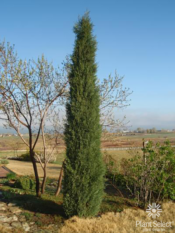
Perhaps an odd tree to start this with, Juniperus scopulorum ‘Woodward’, is not a ‘shade tree’. It is not deciduous. It is a narrow, fastigiate form of Rocky Mtn. Juniper that, growing to a height of 20′ with a 2′-3′ spread can serve as a formal accent in colder climates like ours, a ‘replacement’ for the more tender Italian Cyperss, and it can do quite well here with very little supplemental water.

Trees, specifically ornamental shade trees, have become an expected and desired part of our urban lives, at least util their leaves fall and await our cleanup. Many associate long tree lined streets and avenues with urban living. Broad Maples. Lofty Elms. Plane Trees and, in tighter spaces, perhaps Cherrys, Crabapples and flowering Plums. Urban trees provide several notable ‘environmental services’ increasing our comfort level with their cooling shade, their capacity to remove pollutants from the air, cover and nesting places for birds, food sources for the insects which the birds rely on and the sequestration of carbon. Trees are generally viewed as a public good, necessary even for our lives. We can get quite emotional about them. So it seems a bit ‘wrong’ to suggest that this ‘ideal’ may not always be ‘best’ or even desirable.

Broadleaved deciduous shade trees are ‘naturally’ members of mesic, temperate to cold-temperate regions of the world. That is where they evolved and where when we plant them out, where they do best. When we begin planting them outside of their historic natural ranges, especially when we ignore the conditions, the disparities and the extremes between their natural ranges and those where we choose to plant them, then we can have some serious problems. The trees may struggle along, or if we remain committed to making up for our local area’s lacking, usually in the form of supplying more water, they can do reasonably well. But this suggests possible real problems as one moves further away from the conditions of a tree’s natural limits and increase the numbers planted out. Where is this water coming from and what are the impacts of removing this water from its normal and healthy cycling of which it is a part? What will be going without? And, is that cost worth the losses it creates? Our selection and planting decisions depend on how we value that which is lost! In short, the typical deciduous shade tree of our imaginings do not belong here in a desert. Continue reading →

Mowing Firebreaks Across the Dry Canyon Bottom, Good Idea or No?

Mowing weakens the native plant community and aids the growth of weeds.

Mown adjacent to unmown. Aggressive spreaders will fill in more quickly and because of the weeds already in place, they will sieze a larger proportion of the mown area as they grow and spread.

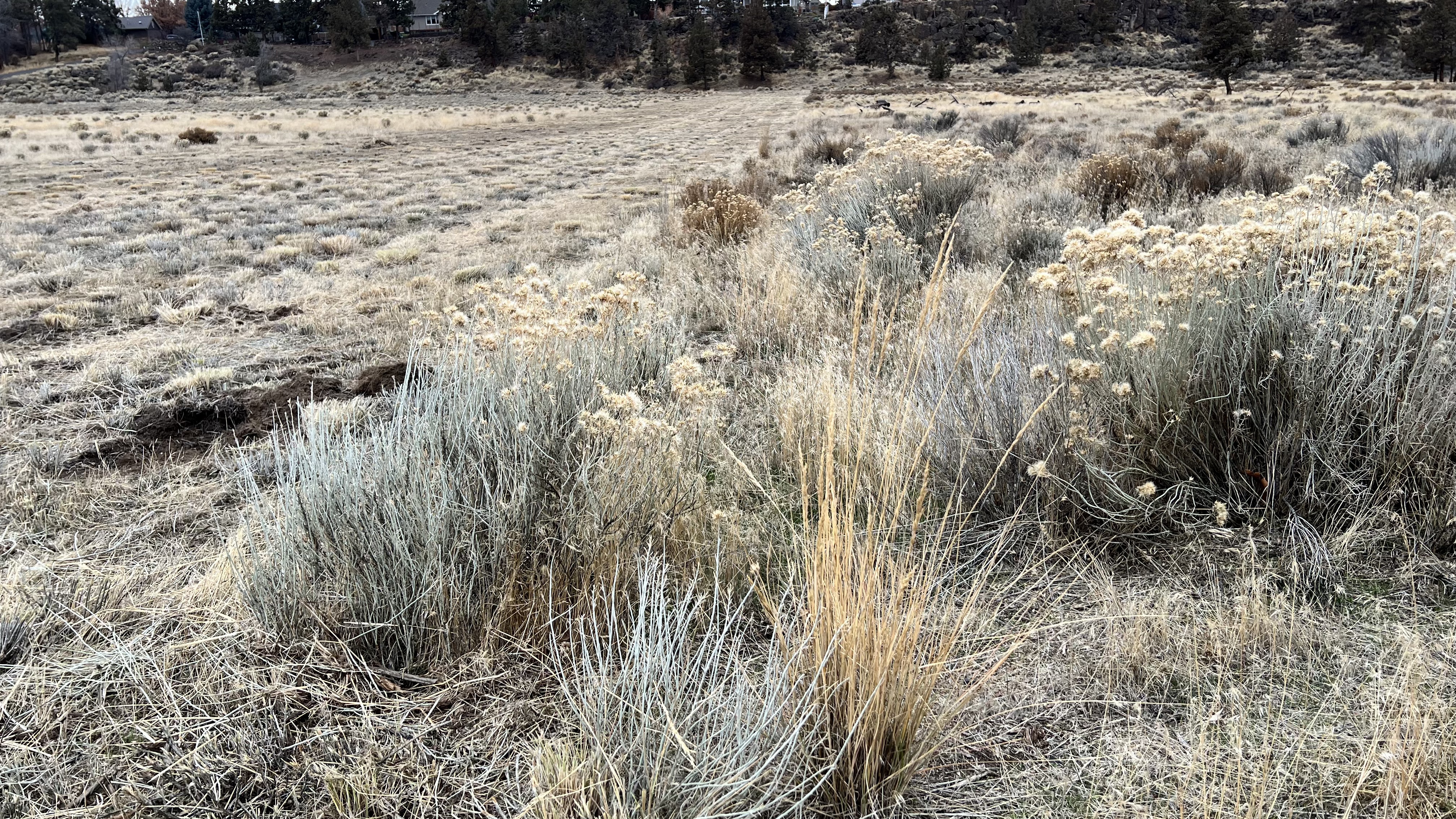
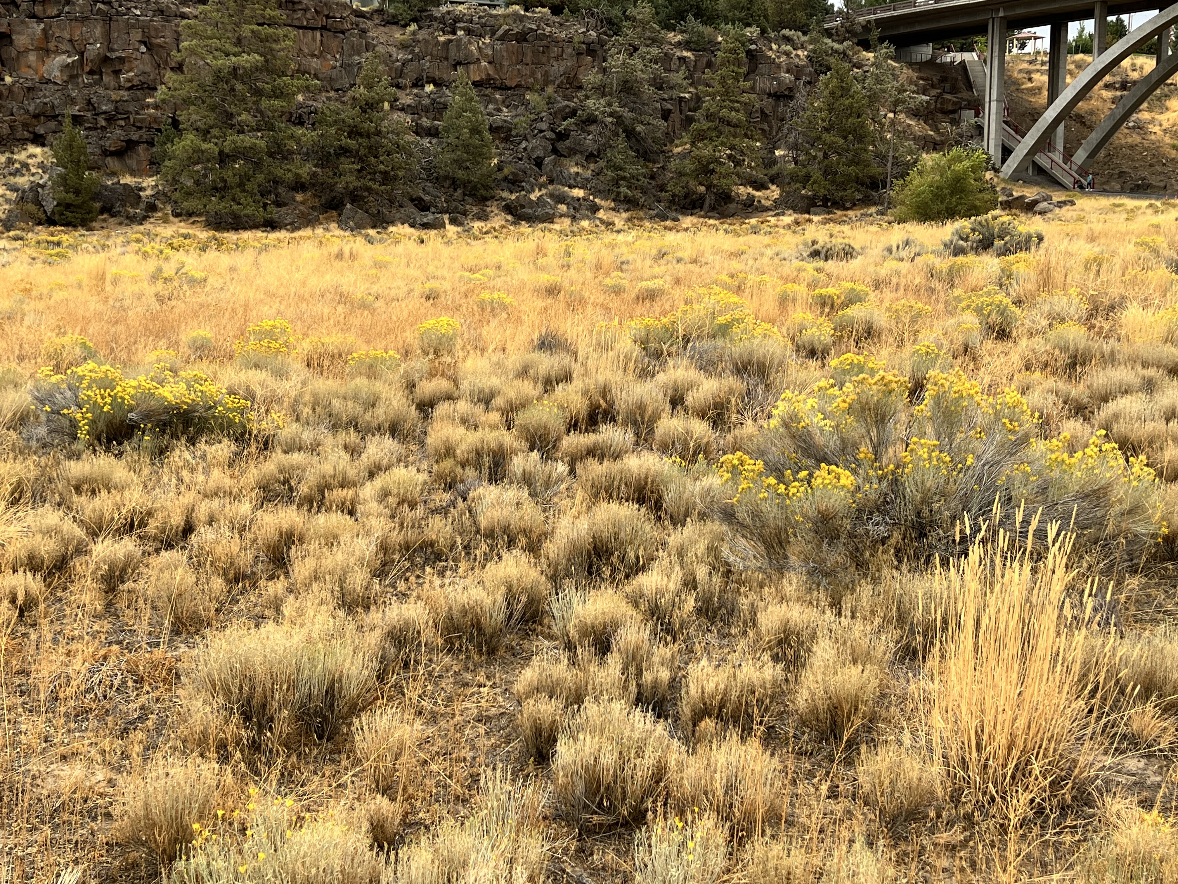
While recently walking home through the Canyon, last month in December, I noted 8 new  strips, presumably ‘fire breaks’, mown across relatively flat and uniform sections of bottomland, each maybe 50’+ wide, spanning the bottom between the paved eastern path and the the main dirt western bike path. While I understand the thinking here, removing ground level fuels, this is a single purpose treatment that works counter to the Park’s purpose as a natural area preserve. Mowing down the Rabbitbrush, a ruderal, transition species of the Sagebrush Steppe plant community, delays the development of a healthy native plant community and encourages an increased array and density of weeds and invasives. Mowing this way provides open space for weed species already in Dry Canyon, as well as those not yet here, giving them larger ‘launch points’ from which they can spread into the rest of the Canyon. Mowing weakens natives, which are naturally slower to rebound from the damage than the aggressive weed species. Continue reading →

From 0’ – 3,000’ in 70 Million Years:  Building Oregon, Dry Canyon, The Shaping of Redmond and the Geology of the Paleo-Deschutes, Part 2

Clarno Formation – 54 to 39 million years ago.

Getting back to Central Oregon, the Clarno Formation formed much of the region’s base rock, an accumulation of volcanic rock, their sediments and soils in layers to as much as 6,000’ thickness. 6,000’. The area was what geologist call an ‘extensional basin’, a broad low basin between the Blues and Wallowa Mountains and the accreting and volcanic landscape forming to its west.

As the Clarno was forming so was Siletzia off the coast of Oregon, Washington and British Columbia, building up relatively rapidly from intense and volcanic activity between 56-49 million years ago to the west. Siletzia was then accreted to the continent due to plate tectonics. In Oregon this terrane became the area we now recognize as our Coast Range and Willamette Valley.

This area looked far different before this period than at its end. It looked far different again, from when it attained its maximum elevation, to how it appears today. Trying to tack all of this is a bit like trying to follow a 3 ring circus…with many more rings, all proceeding at the same time, with generous overlaps. When looking at our landscape we are faced with the problem of the never ending processes of ‘addition’ and erosive ‘subtraction’. The ‘end’ of the period we define as the Clarno Formation is not one of some final result. The regions canyons, have today been deeply eroded, cut steep, with broken slopes, below the rim tops we see today. These were very different 39 Ma and they will look far more different in another million or ten million years from today, likely unrecognizable to us. Even if we were able to somehow survive until then to observe them, our ‘snapshot’ and pliable memory of them would have likely transformed over the many centuries. Erosion will have been at work over the intervening time together with those forces working to ‘build’ and ‘lift’, the working of plate tectonics locally continuing to drive the process as they continue in their slow motion crashing, transforming the surface from below.

During the Clarno those forces continued with, explosive eruptions, lava and pyroclastic flows, lahars that poured down from volcanoes of the Mutton Mountains in the formations northeast corner and Ochoco Mountains area, just west and south of the Blue Mountains, along with their mudstone, and conglomerates derived from the erosion of both accreted terranes and that of volcanically ‘built’ structures. And thus was ‘built’ the Clarno and the later John Day Formation. The three largest volcanic structures of the period in the Ochocos remain today as the Crooked River, Wildcat Mountain, and Tower Mountain Calderas. These volcanos have not been active for many millions of years. The center of volcanic activity in the region began to shift westerly during the Clarno with the tectonic changes accruing to the expanding continent’s edge developing into what would be the Cascade Volcanic Arc. The Ochoco Volcanic Area remained an active factor on through the development of the John Day Formation Period. Continue reading →

John Vaillant’s, “Fire Weather: A True Story from a Hotter World”

‘Global warming’ and ‘climate change’ have become trigger phrases, hot buttons for millions of Americans. What were originally coined as descriptive, short hands to signify a complex climatological process induced and accelerated by human action, has been thoroughly politicized. Today they separate ‘us’ from ‘them’.

For those on one side, the earth, is a closed, limited and complex system we are ‘pushing’ beyond its inherent abilities to maintain dynamic balance within margins which organisms can live in a vital, healthy state, biological processes continuing in a familiar manner. This ‘side’ understands that we are adding vast quantities of carbon to the atmosphere causing the earth to retain more heat, heat which ‘spins’ the entire system faster, potentially beyond the limits that life evolved with. Such a more ‘carbonized’ atmosphere resembles that here of many millions of years ago, of a warmer earth, that was nonsupportive, too warm, for the vast majority of organisms which exits today. Too much carbon released into the atmosphere? These effects are easily demonstrable in a lab experiment. These people have some understanding of what they must do to slow and halt these changes, what we must do  to ameliorate the damage we’ll inevitably face. Pushed too far the system won’t return to the old ‘normal’ in a few weeks, months or years. It will be with us for generations to come.  Continue reading →

Two Summers into Our New Garden in Redmond, Oregon’s High Desert Country

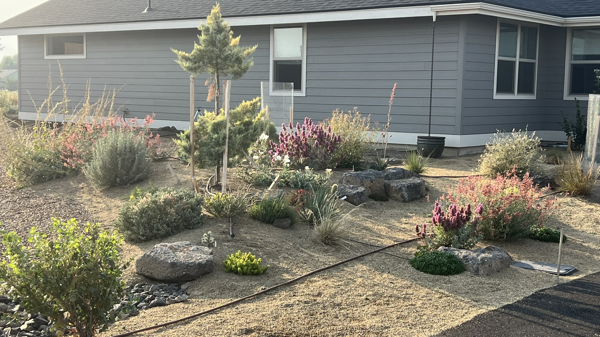
Part of the S’W Arc Garden’ featuring plants from the SW US. My Cupressus grayii Sulphurea showing the damage wrought by a rutting buck last fall. The low berm was created from the material produced by regrading the abrupt drop to the sidewalk. The rock was used here and in back. I also collected a couple tons of rock to use from elsewhere on undeveloped parts of ‘Dry Canyon Village’ and placed an additional almost 20 yds of topsoil.

We’ve just gone through our second summer season in the new garden beginning with a blank slate other than the local weeds. While I grew up here we’d been ‘gone’ in Portland where we lived, worked and gardened between the Fall of ’85 and ’22. It’s a world of difference here three USDA hardiness zones colder where our last two winter’s have subjected us to long Zn 6b conditions, -5F while Portland experienced its far shorter winter and cold down into the mid-teens, which is colder than their new ‘normal’ range of lows which puts them in Zn 9. One of the biggest differences is that in the past rain year, running from Oct. 1 – Sept. 30. we’ve received only 6.66″ of precip around 2.5″ less than our 9″ or so normal. It’s colder here; the growing season is far shorter, yesterday, Oct. 5, we dropped to 30ºF; drier; the wind blows more consistently and the solar radiation is more intense at 3,000′; all of which greatly effect both what you can grow here and how it performs. Gardening ‘know how’ can only get you so far. I’m not really going to get into the deer problem here and it is a problem as we are on the edge of town adjacent to a major Mule Deer wintering area. Anyway, as gardening is always at least a bit of an adventure, these last two have been far more than a ‘bit’. Continue reading →

Climate Change and the Limits to Life: a couple reviews and examination

Not to ‘rain on anyone’s parade’, but walking home last night at 10:30 from a neighbor’s, the air was still, it was 81F and 51% humidity…ugh. Normally, it cools off significantly here in the high desert once the sun goes down. This summer is different.
Today, August 2, we’re forecasted to break 100F again. That will be the 26th day over 90 this year, the ninth over 100F…with less than 1/4” of rain since June 1. I’ve mentioned before that our average high temp for July is 85F. We were at or below that only four days in July.
Our old normals no longer hold. They are shifting consistently higher from year to year. This is happening worldwide. Its effects are greater, and more devastating, at equatorial latitudes and polar.
It is estimated that at or above a wet bulb (W/B) temperature of 35C the human body cannot cool itself. We cool down by evaporating away sweat on our skin surface. W/B temps mimic this by placing a wet cloth sleeve around a thermometer bulb, the evaporation taking away heat in the same way. W/B temps are then cooler, ‘chilled’ by the water evaporating away, drawing heat away from the thermometer’s temperature sensitive bulb, than ‘dry bulb temps. When these rise higher than W/B 35C, our internal organs and systems begin to falter and will fail in relatively short order, depending on our state of health. Some of us will have greater tolerance than others, but all will die at these levels if they have no way to cool their core temperatures. Some argue that this begins happening below this. Many areas are already experiencing such ‘events’. Governments are still slow to act We continue to build out our cities in patterns that maximize energy use and consume resources and products from around the world which must be transported to us, removed from where they other wise occur. Profit driven businesses, still refuse to change their practices and goals, insisting that the market will solve this…the same market that has created the problem…and we ‘demand’ this, these patterns, goods and services, ever more ‘divorced’ from the places we actually live, the limits and constraints with which we’d otherwise have to live.

Continue reading →

On Healing: Life, Place and Relationship in Oregon’s Great Basin Country

The massive fault block of Hart Mountain, Poker Jim Rim in the distance to the north. The gravel county road switchbacks up the more than 3,000′ beginning from the center in the distance here. From here this is how you get to Steens Mountain without doing miles of backtracking.

I woke up this morning to the sound of bird song…nothing else. There were Western Meadowlarks and a multitude of others, I’m sorry to say I don’t know, but beautiful and distinct. I was laying in bed, atop our truck, thinking about how rare an event this is for so many of us…not that the birds aren’t here greeting the morning every day, but that so many of us aren’t ‘available’ to hear them, sequestered away safely in our homes, otherwise occupied or, more commonly, the birds literally excluded from our urbanized and ‘modern’ places of residence, their own places developed/destroyed. Entire neighborhoods and cities excluding all but the most common songbirds and passerine species.  Little quarter is afforded most wildlife in modern development…and that upon which their lives depend.  Continue reading →

Dry Canyon Proposal: the need for change in maintenance, use and planning

[The following is a piece I wrote and sent to our local Parks staff, its advisory citizens committee, mayor and city manager…I got little back in response. I’ve developed a relationship with one of the city arborists and the park’s planner as well as have met several active neighbors interested in protecting Dry Canyon’s natural areas, several of whom have natural resources backgrounds with agencies. The City has no natural resource or botanical staff. There is no formalized friends group, nor is their an outreach and public education program that addresses these problems and the role of residents in their solution. Signage is minimal and inadequate. Their horticultural expertise would also seem quite limited. This is understandable as the City’s population has grown very rapidly in recent years. The need for such programs and an increase in expertise on staff will only increase as Redmond’s population continues to grow.]


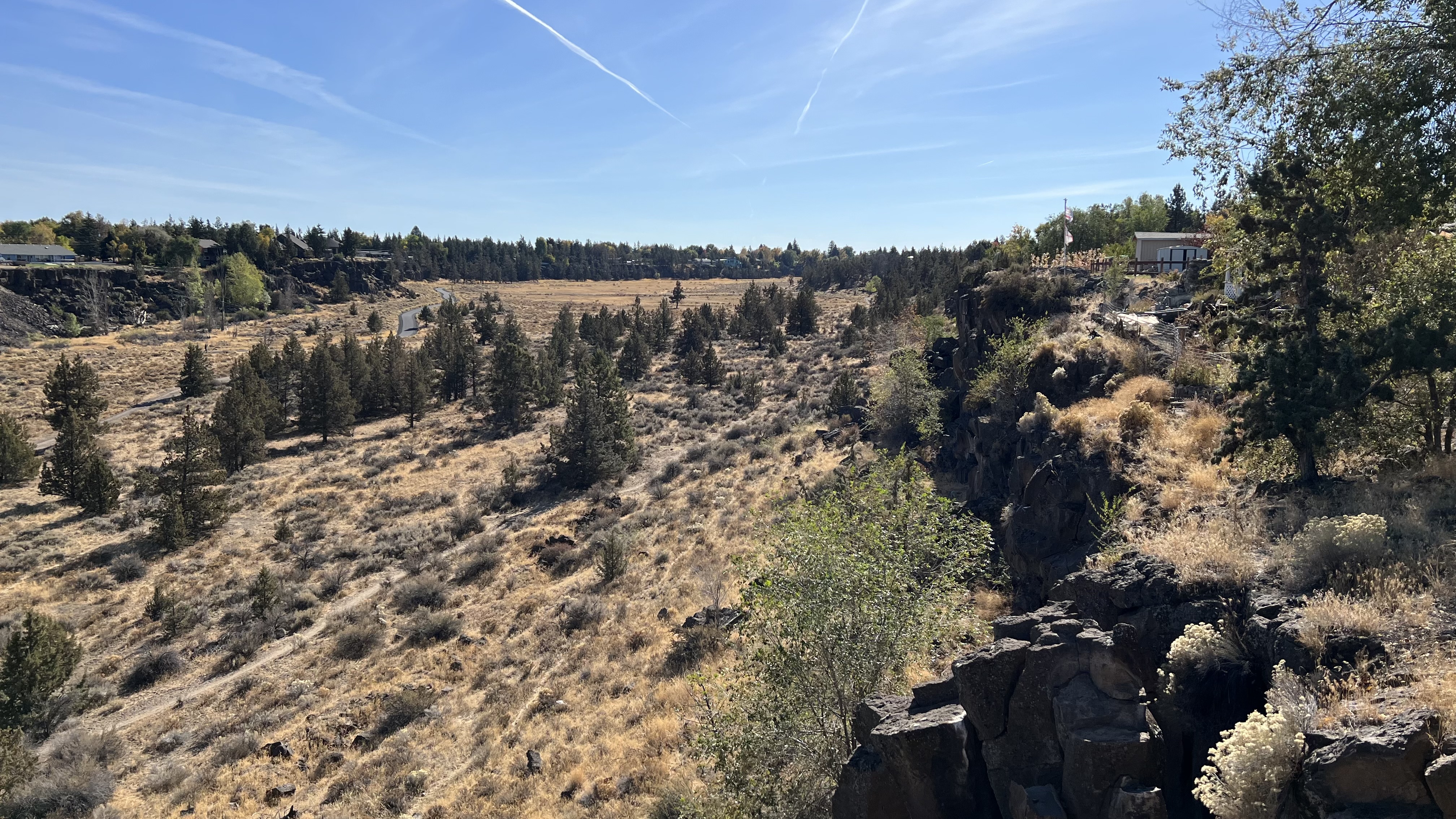
Redmond’s Dry Canyon looking south from the west rim on the Maple Street Bridge. The area in the immediate foreground burned this last summer.

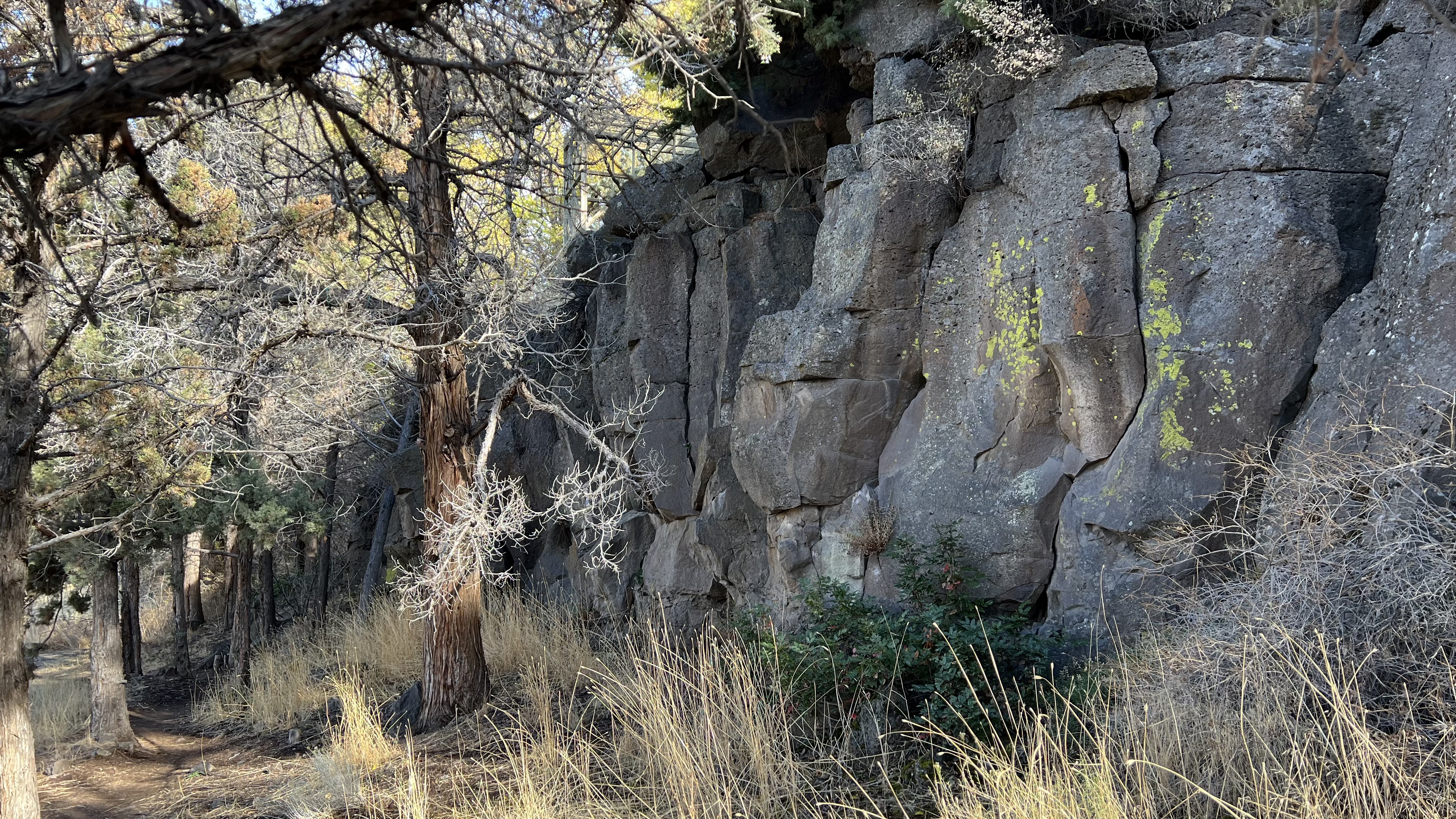
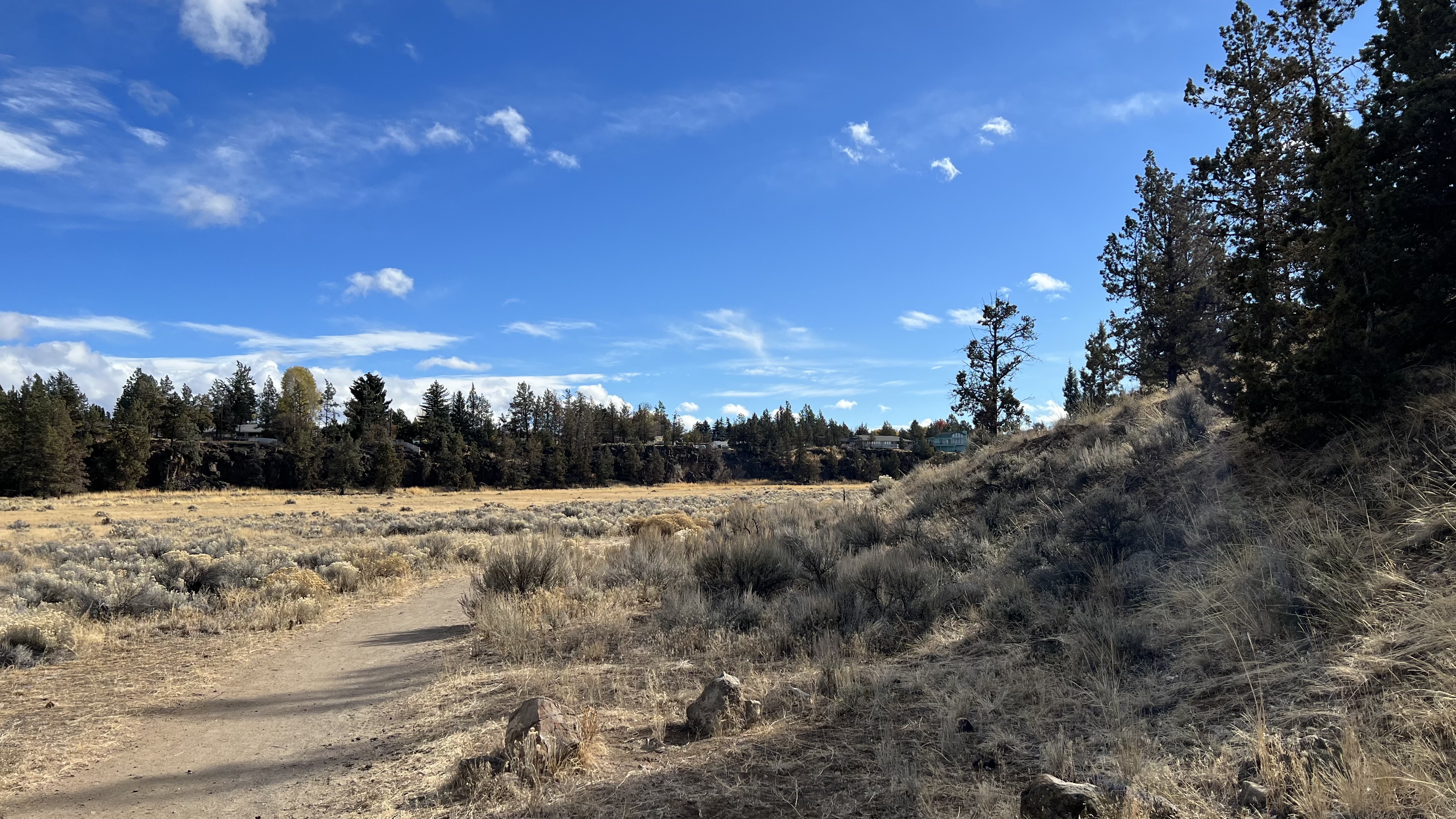
A typical view at the base of a section of relatively unbroken rim on the east side.

The canyon floor is variable, but as this pic shows, a solid layer of hardened lava underlies what soil is here, either blown in or washed in, a limiting factor of what can grow here. Rabbitbrush is a common and ubiquitous native pioneer.

Match of the canyon floor is recovering from pasture use. These areas have relatively deep soils and are still transitioning with many weedy mustards, annual grasses like Cheat and planted grasses like Crested Wheat and Annual Barley. Native Bluebunch Wheat is scattered as are other natives. Gray Rabbitbrush, a native seral species has moved into much of it, but the weeds are dominant. Sagebrush and Bitterbrush are more at the edges and lower rim areas.

This section of bottomland, former pasture, probably burned not that long ago, has quite a colony of Rabbitbrush coming along, all it would appear of even age, suggesting a fire. Rabbitbrush are early colonizers and ‘prepare’ the way for natives to follow. This is just north of the Maple Bridge.

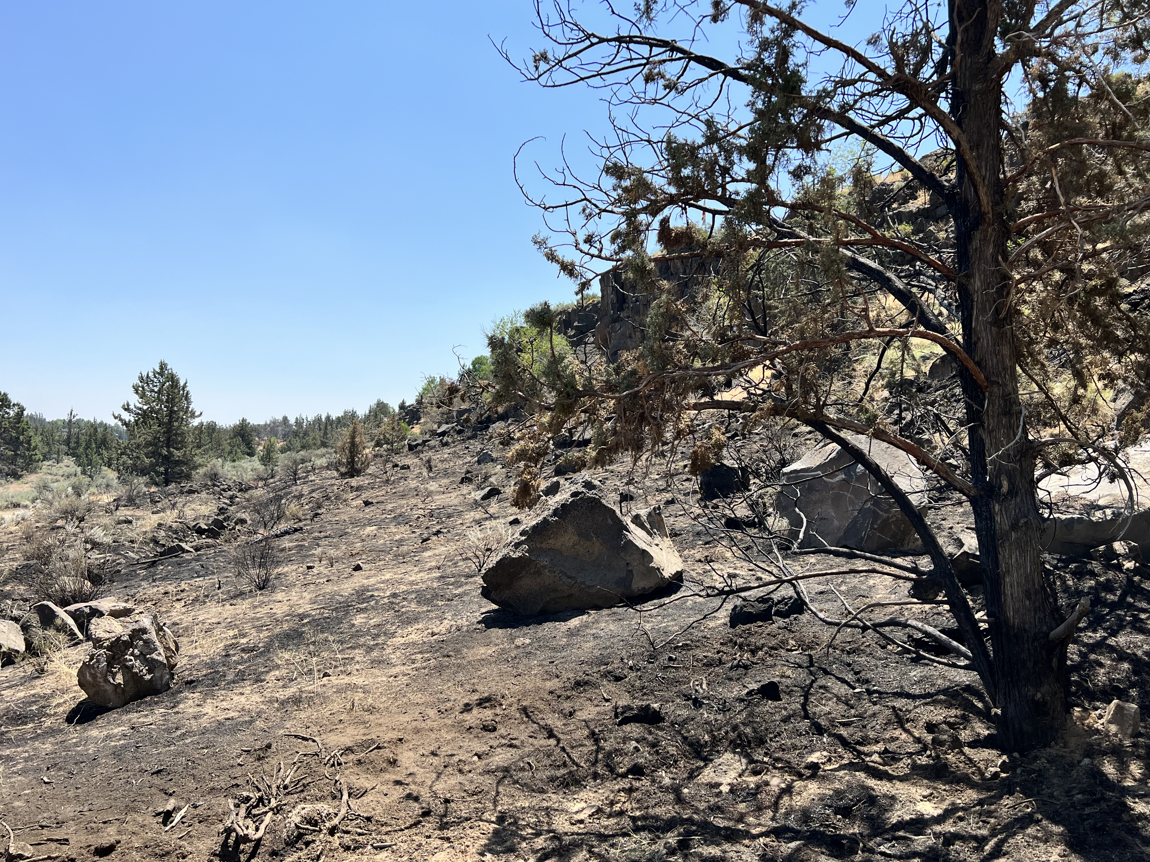
This area, maybe 5 acres, burned in July. It will be interesting to see what comes back and what the City may plant??? Fire kills Sagebrush and Juniper, while it seems to favor Cheatgrass. So far, April ’24, nothing has been replanted. The window for seeding is closed. Rabbitbrush can survive a burn. This site is unfenced, with very fragile soils and we’ve already observed new bike trails in it.

My wife and I are both recent returnees to Central Oregon having both grown up here. We are also frequent walkers in Dry Canyon, a place I spent many hours in playing and exploring as a kid in the 60’s. Redmond has changed a lot over the intervening years…change that continues apace as it grows. I’m not going to whine about the ‘good old days’ and things lost. Much of the change I welcome or at least accept (We did move back!), but population growth, in addition to bringing along economic vitality and stability, new and enriching opportunities and a more diverse community, increases the ‘pressures’ on the naturally limited assets that largely define the place and attract residents. I’m speaking here of the natural landscape, its features and the opportunities which it affords us for recreation and quiet enjoyment. Realtors were once fond of saying that no one is making new land, as a prompt for buying…it is a fixed and limited quantity. This limitation has profound implications for a growing population. We have far more people today ‘enjoying’ a limited, and increasingly over utilized landscape. Continue reading →

Knapweeds in Redmond’s Dry Canyon and the Pursuit of a Healthy Landscape

Redmond’s Dry Canyon looking south from the west rim on the Maple Street Bridge. The area in the immediate foreground burned this last summer.

If you garden, or maintain a landscape, you come to understand that not all weeds are the same. Each will have its own ‘strengths’, or perhaps you might call it ‘virulence’. Any particular weed, just like any other plant, will respond ‘positively’ to supportive growing conditions, conditions which often closely align with those which exist in its place of origin. Plant explorers and nursery growers are always looking for ‘new’ plants for landscape use. in a way, they have to walk a fine line. They must find plants, that with reasonable effort on the part of the gardener, can thrive across a range of conditions, unless they are looking for specialty plants, for narrow, niche, markets. The introduction of new plants must be somewhat measured, our enthusiasm tempered, because plants which are too adaptable, too vigorous, may possess the ability to escape our cultured gardens and find a place in the surrounding, uncultivated, landscape.

For Central Oregon, when we look beyond our regional natives, we must keep this in mind. Exotics from similar growing and climatic regions around the world offer both promise and threat. We want our plants to be successful, but not too. Sometimes through the process of trade, the movement of livestock and agricultural products, particularly aggressive species hitch a ride. A few weed seeds can be easy to miss. If they are aggressive enough and go unnoticed, a distinct possibility, it is likely that they wont be detected until a sizable local population asserts itself…and if no one is watching, that can be a fateful error. One group of plants, with many wonderful possibilities, also include species which can be exceedingly problematic here in Central Oregon, these are from regions sometimes referred to as Steppe. Continue reading →